Category: Articles

Articles about wayfinding and environmental design.

  • Visualizing Direction and the Use of Arrows

    Visualizing Direction and the Use of Arrows

    Visualizing Direction and the Use of Arrows

    How graphic arrows support our natural abilities and make us better wayfinders

    Visualizing Direction and the Use of Arrows
    Illustration by Joseph Mackereth

    I’m in the group of people that finds inspiration through nature. There is nothing better than a hike in the woods to clear my head and spark creativity. Admittedly, my love for nature comes from a degree of restlessness and wanderlust. I can’t stay idle for too long, and exploring an unfamiliar path can break up the rhythmic patterns of life. This level of leisurely escape is only possible when we trust our navigational abilities. Otherwise, we are just lost in the woods — which is a completely different experience.

    We have many navigational tools at our disposal to help us explore the unknown. Our most powerful tools have been endowed to us through evolution. The human brain is capable of codifying spatial and sensory information into a cognitive map. Developing a cognitive map of unfamiliar places by codifying spatial and sensory information is a complex process that neuroscientists are helping us to better understand. Over the past few decades, these scientists have identified specific cells associated with navigation in different areas of the brain — place cells, head direction cells, boundary cells, and grid cells.
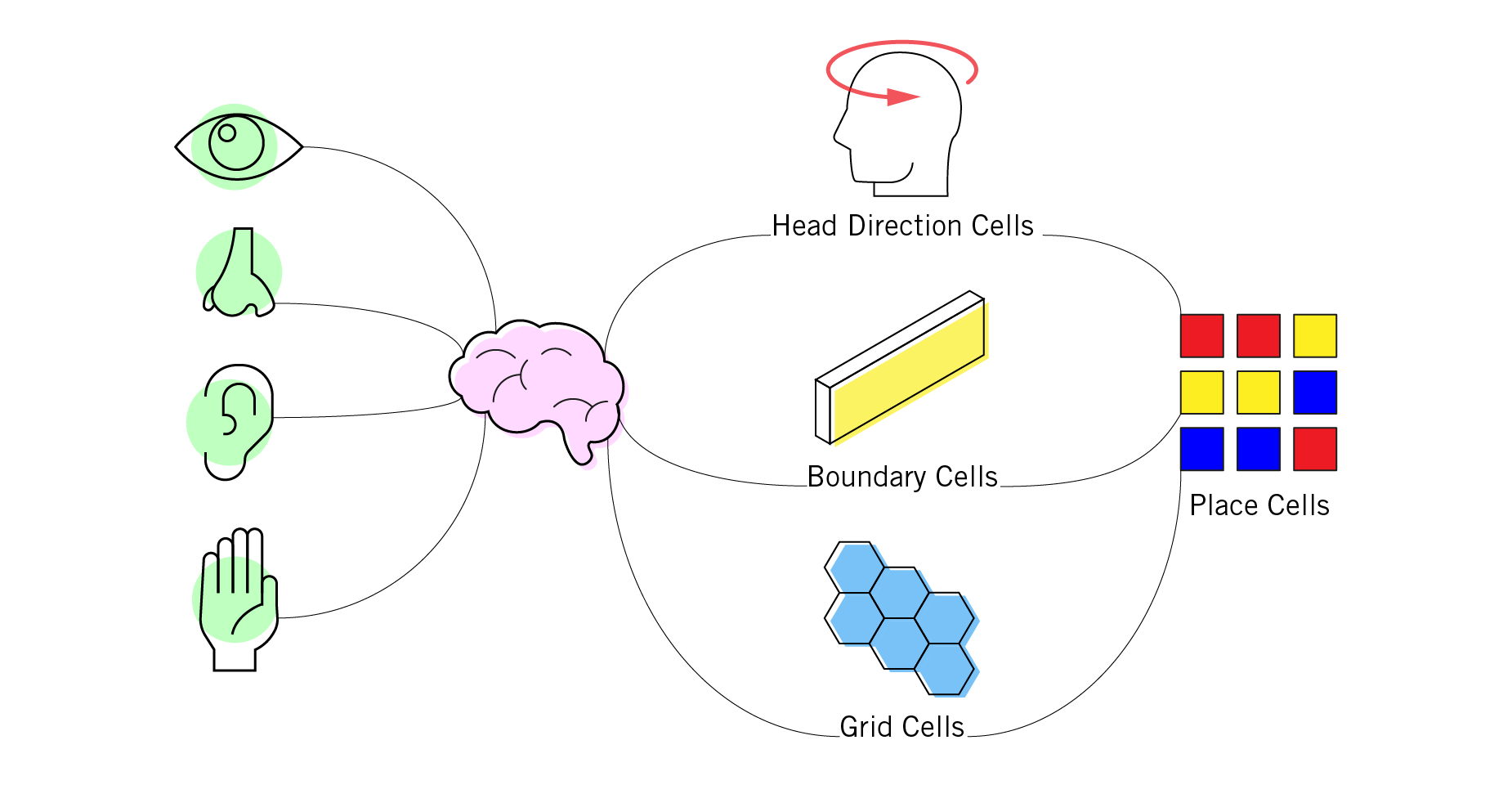
    First identified by neuroscientist John O’Keefe in 1971, place cells record the uniqueness of the place by firing in a specific pattern. No two patterns are alike, and these distinctive patterns form the basis of our cognitive map. The discovery of place cells eventually led to the identification of additional cells linked to navigation. Head direction cells help us determine what direction we are facing by orienting our bodies to prominent features in the environment, sort of like an internal compass. Boundary cells calculate the distance between our bodies and surrounding objects or obstructions.

    Grid cells generated a lot of excitement in 2005 when they were first discovered. Scientists are still working to understand the complete function of grid cells and their connection to the other navigational cells. It seems that grid cells are able to keep track of our position and distance traveled using a hexagon grid that is mentally superimposed over an area between boundaries. The grid can be imagined as a honeycomb tile floor that our mind uses to keep track of our movements as we walk. There are different sized grids stacked on top of each other in the entorhinal cortex portion of our brain. Having different size grids helps with path integration by keeping track of large or precise movements. This way, when we walk from our car into a supermarket, we know exactly where to step to avoid the automatic door and can also keep track of our car’s location in the parking lot behind us.

    Even with these amazing cognitive abilities, finding our way can be hard. Really hard. Humans are not as skilled as birds, whales, or other super navigators when it comes to traversing long distances, but we’ve created our own advantages when it comes to unfamiliar journeys. Through cultural refinement and technological advancements, we’ve developed additional tools to help turn our local environments into categorical information. With this information, we can design systems that support our natural navigation and better orient our bodies in the physical world.

    Example of a rock cairn. Photo by Luc Santeramo on Unsplash

    The way in which humans have expressed direction has changed throughout history. We’ve utilized markers like rock cairns and trail blazes, documented the natural world — both topographical and celestial — and developed unique naming systems to help guide us along. Once we began reshaping our physical space through the built environment and changing our methods of personal transportation, we needed to adjust how we communicated directions. We could no longer rely on nature alone for navigational clues; our supportive tools became our primary source of orientation. The simplest and most effective of these supportive tools became the graphic arrow.

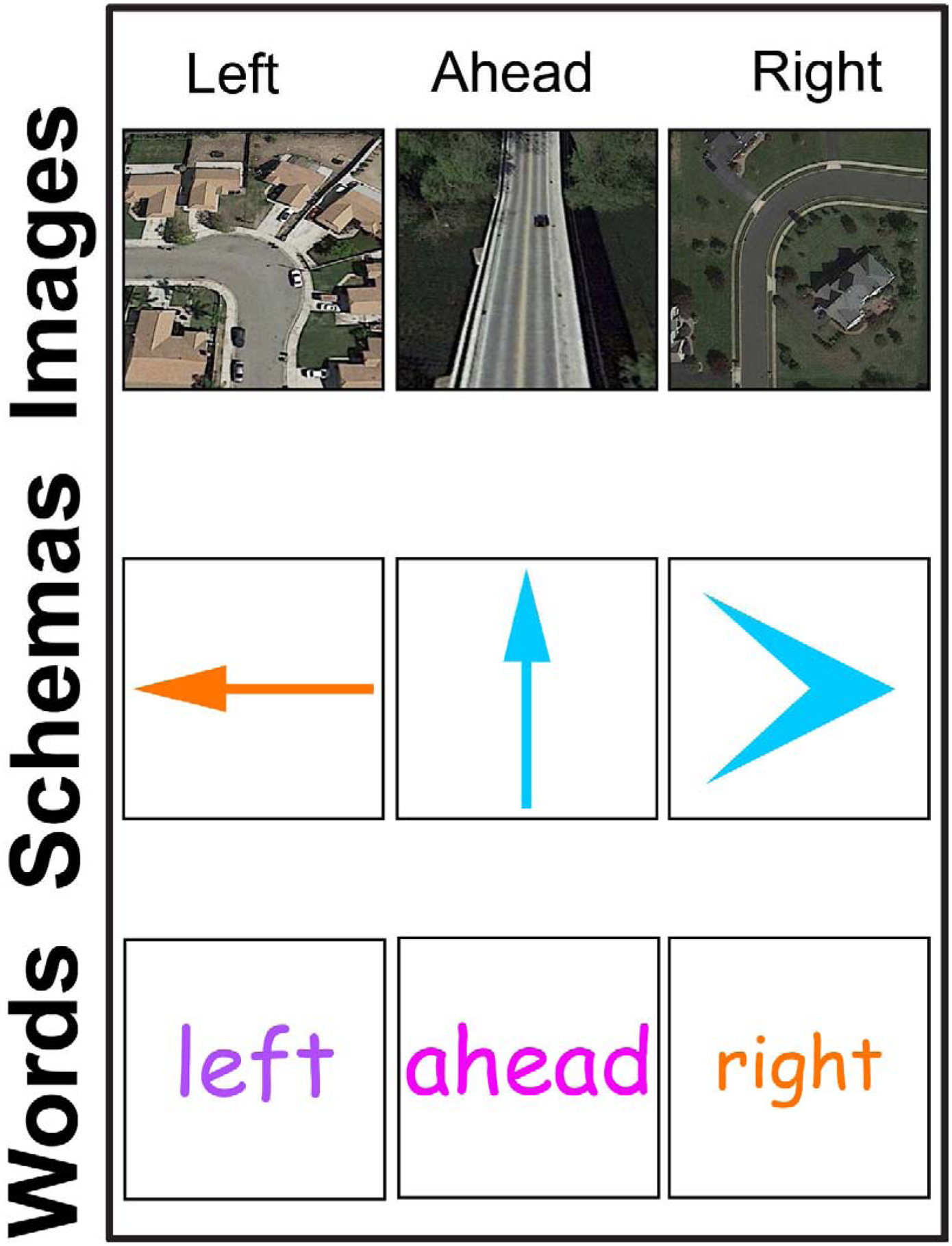
    To better understand the effectiveness of supportive navigational tools, Steven Weisberg at the University of Florida examined how people reacted to different directional information. He used an experiment with seven different directional cues (sharp left, left, slight left, ahead, slight right, right, sharp right) and asked participants to view different types of images representing those seven directions. To represent a specific direction, like left, the experiment utilized photographs (an aerial view of a road turning left), schemas (an arrow pointing left), and language (the word “left”). Participants would have to remember the direction from the previous image and confirm if the current image was the same or a different direction. The types of images were shown at random, and the experiment recorded participants’ reaction time to correctly confirm the direction.

    The study found that between images (photographs), schemas (arrows), and language (written directions), arrows had the quickest reaction time to confirm the correct direction. Written directions had a little longer reaction time than arrows with some extra time needed to mentally convert the words into geometry. Photographs had the worst reaction time of the three, which was attributed to an excess of detail and non-directional information embedded in the image. The arrow became an effective tool because it communicates directional information with a few simple lines. It reduces the visual noise of our surroundings and focuses it on a single directive.
    Graphically, the arrow symbol isn’t much different from its precursor — the physical hunting arrow. Early graphic depictions of hunting arrows in prehistoric cave paintings still contained all the visual characteristics needed to communicate direction. Graphic designer Bruno Munari described it as trapping the eye and then allowing it to escape. The hollowed-out triangle offers space for the eye to settle and become trapped, while also giving it an escape route at a converging point — a process that mimics direction (Diagram 01). Utilizing its ability to mimic direction and movement, information designers have championed the development of the graphic arrow. Between maps, diagrams, signs, illustrations, and user interfaces (to name a few), the arrow has become the de facto symbol for direction.

    The hollowed-out triangle offers space for the eye to settle and become trapped, while also giving it an escape route at a converging point — a process that mimics direction.
    Diagram 01

    When arrows are introduced into the built environment and are placed on surfaces, they activate the surface plane to trigger directional cues. The surface plane becomes an anchor from which to delineate the relationship between our bodies and pathways. Viable paths are identified by comparing the arrow and surface plane to surrounding boundaries and obstacles. Since pathways are essentially empty space, with no objects to impede our travel from one location to another, there are no objects with surfaces upon which to apply the arrow. Instead, we have to settle for placing our directional information on adjoining surfaces. An arrow needs to reside on the surfaces of neighboring objects, which makes the relationship between arrows, surface planes, and pathways dynamic. An arrow that points to the sky might mean up, but it could also mean straight ahead depending on the context of our surroundings and our current position in space.

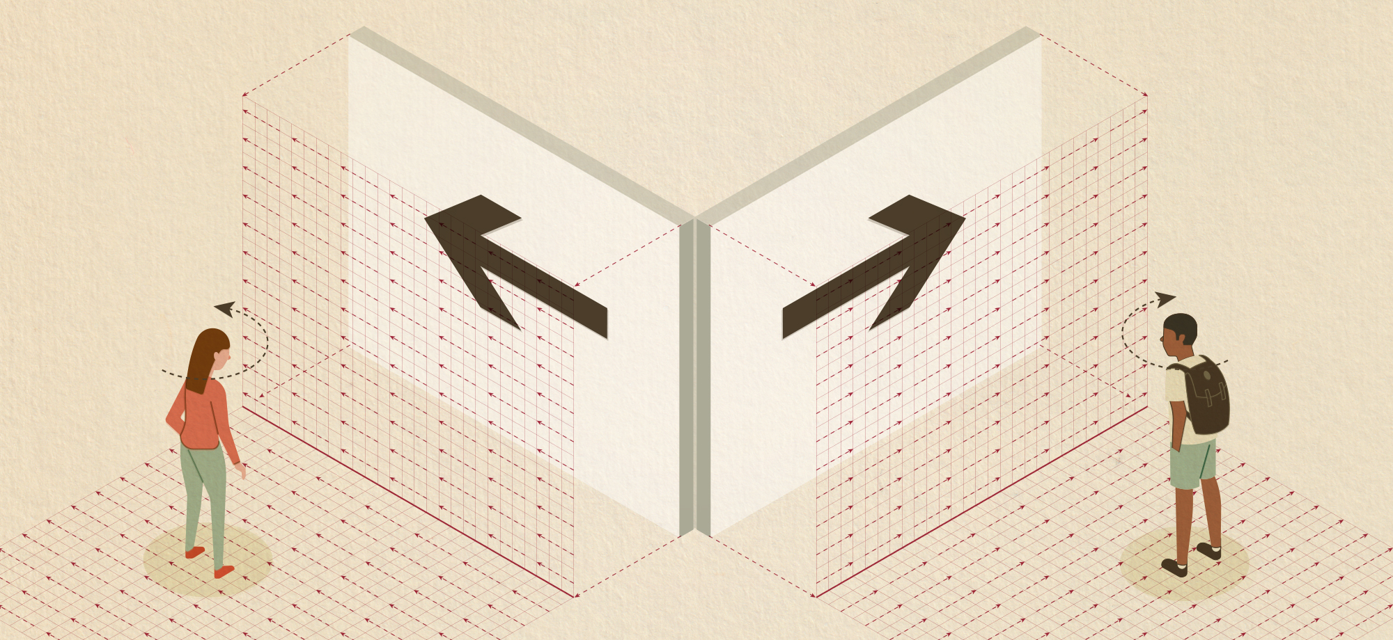
    By picking up on environmental clues, humans are capable of taking the arrow from its surface plane and projecting it mentally onto the emptiness of pathways. Arrows placed on the ground need almost no projection, they live on the plane in which we travel. Moving the arrow to a wall or other upright surface may or may not require complicated projection. An arrow pointing left at the intersection of two corridors only requires us to rotate our position left (Diagram 02); same for a right arrow. Up and down arrows make sense when paired with stairs and elevators. This relationship is still one-to-one with our bodies.

    People are capable of taking the arrow from its surface plane and projecting it mentally onto the emptiness of pathways.
    Diagram 02

    Sometimes, often found with vehicular signs, that projection may be the ground plane lifted to a perpendicular orientation. The up arrow means straight and the left arrow means left, etc (Diagram 03). Signs that are perpendicular to the ground plane can also represent pathway alignment. The arrow now means “this lane” or “this portal” and is common in both vehicular and pedestrian signage (Diagram 04). We just “know” which plane the arrow is being projected on, partly from our spatial cognition and partly through trial-and-error experience. There is always some room for confusion. Like the dreaded off-ramp arrow: I feel like I always have a 50/50 shot of interpreting that arrow correctly.

    Arrow projection may be the ground plane orientation lifted to a perpendicular position.
    Diagram 03
    Signs perpendicular to the ground plane can represent pathway alignment.
    Diagram 04

    Despite some level of uncertainty, it’s pretty amazing that two or three lines can transcribe space and the action needed to move through it. Each arrow we encounter on a journey behaves like a checkpoint of sorts — “You’ve made it this far, now venture forth in that direction!” Having checkpoints allows us to have confidence in our decisions and removes the anxiety of being lost. To travel without anxiety is to wander freely. It’s in those moments of purposeful exploration that we find something new. Hopefully it’s on to a new source of inspiration.

    Article first appeared in Nightingale: Journal of Data Visualization Society.
    Thanks to my Editor
    Mary Aviles
  • Wayfinding Is Where Place Meets Information Design

    Wayfinding Is Where Place Meets Information Design

    Wayfinding Is Where Place Meets Information Design


    An introduction to wayfinding, an interdisciplinary approach to solving navigational problems

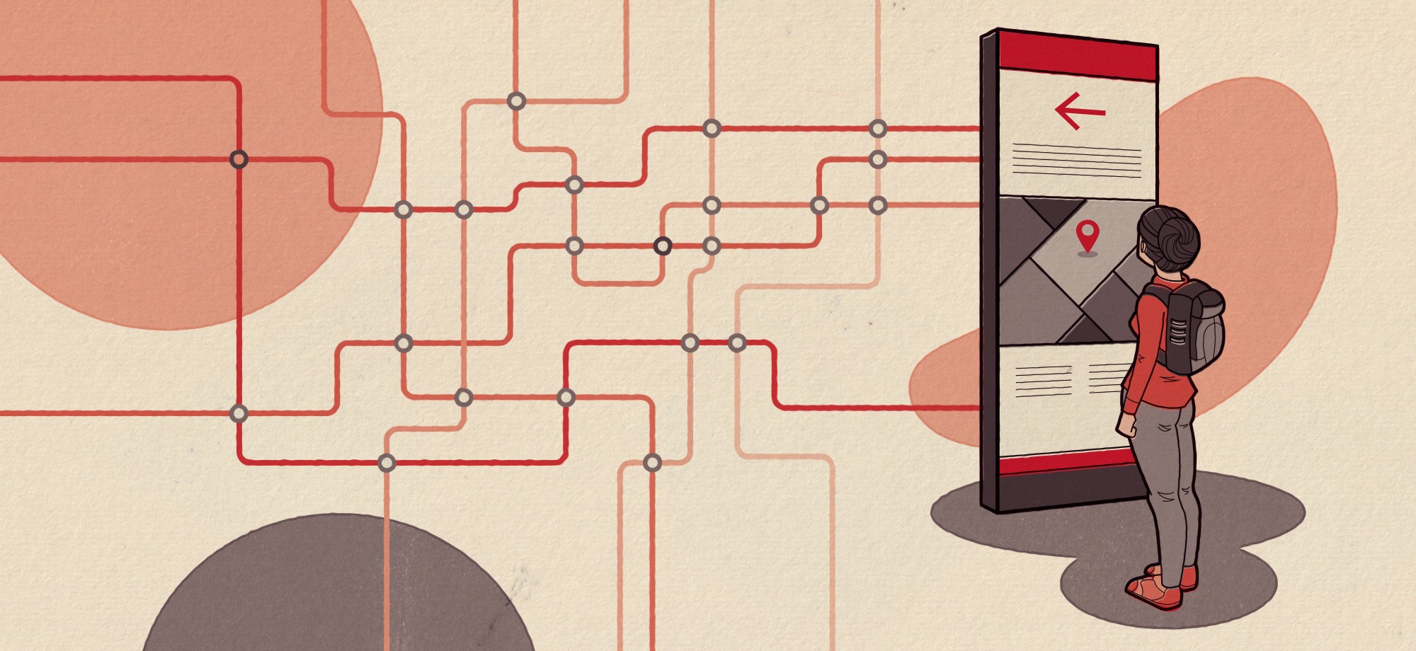
    Illustration by Joseph Mackereth

    Have you ever wondered what the world looked like before the advent of signs? In one form or another, humans have always used signs to identify, direct, and inform each other about the world around them. My favorite example is from ancient Rome, when taverns were marked by placing an ivy bush by their entrance. The bush was visible to anyone walking by, letting everyone know that food and spirits were available within. I like this example because it highlights the simplicity of signing but also the complex social contract involved to make it work. Without the cultural context, the bush would mean nothing.

    Anytime we read a sign or follow directions, we are doing a little mental gymnastics in order to decipher the information. Between the physical marker and the information needed to be relayed, there is a cognitive gap that is filled by our understanding of language, spatial awareness, and cultural symbols. Because signifiers can be interpreted differently based on a person’s understanding and personal experience, this gap can be the catalyst for confusion. Just think about the last time you tried in vain to understand a confusing street parking sign. Is it okay to park here? Who knows? The sign is trying to tell me where I can park — but I can’t figure out where that is. I’m just going to park here and hope I don’t get a ticket.

    Long row of confusing parking signs in Culver City, CA.

    In the mid-20th century, a handful of architects, designers, critics, and scholars set to work on closing this cognitive gap by developing a methodology around sign systems. At the time, globalization was in full swing and built environments were becoming more complex and difficult to navigate. Large metropolitan areas turned into international crossroads with travelers from all around the world. The people working on these large-scale projects needed a way to evaluate their sign systems to make sure information was being effectively disseminated. By pulling from their respected fields, these early pioneers develop a new discipline called “way-finding,” which combined the adjacent fields of information design, graphic design, and industrial design.

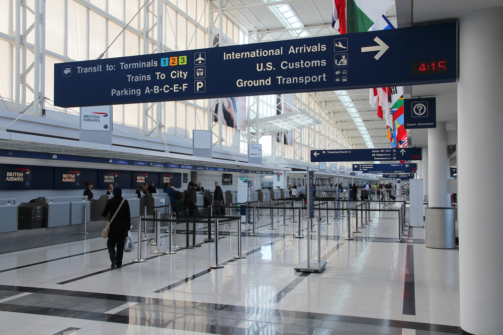
    Travelers check in at Chicago O’Hare International Airport while directional signs hang overhead.

    Wayfinding is an interdisciplinary approach to solving navigational problems. By implementing information design techniques — first by defining the problem, collecting data points, prototyping and testing solutions, and evaluating the solutions based on user interactions — wayfinding is able to bring order to large and complex spaces. In order to communicate that information in a clear and compelling manner, wayfinding has adopted graphic design theories of ideation, typography, and iconography. Industrial design rounds off the wayfinding process to solve three-dimensional problems and integrate built structures into the surrounding environment.

    Hidden in Plain Sight

    We actually interact with wayfinding systems all the time — mostly without knowing it, or at least not knowing what to call them. Airports, train stations, universities, museums, sports stadiums, hospitals, vehicular traffic signs, parking garages; almost every public space incorporates some sort of wayfinding system. The signs, maps, markers, digital screens, and directions we use to navigate a space were planned and designed by someone. If the planning and implementation is done right, you won’t even notice it. Like good typography, good wayfinding is invisible. The user won’t stop to consider the how or why, but will simply interpret the information quickly and use it to make their directional choice.

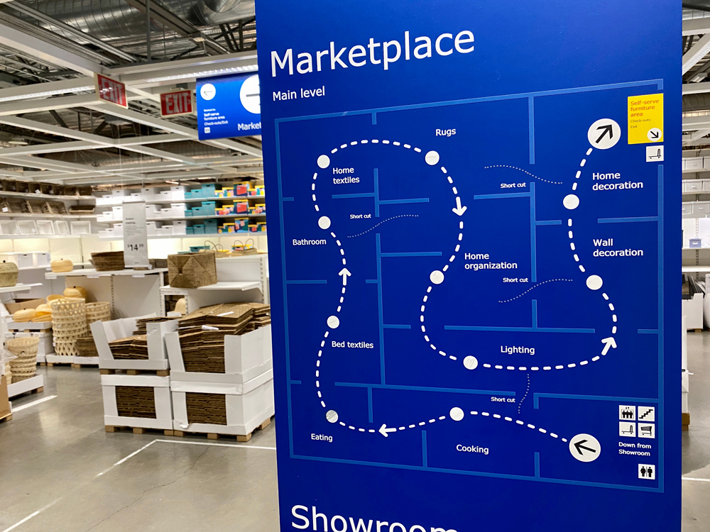
    IKEA furniture marketplace showroom navigation map.

    One place where the wayfinding system is front and center is IKEA. My family took a ride out to IKEA about a year ago, when my daughter was 4. My wife was looking for some kitchen gadgets, but I took the opportunity to explain wayfinding to my daughter and show her what I do for a living. We made a game of it — like pirates looking for treasure. First, we found our location on the map.

    “Okay, we are here and we need to go there.” I said pointing at the map with my finger. “Which direction should we go?”

    She looked at the map and then looked around the store. Her mind was relating the two — the real space and the abstract version of the space. “This way!” she exclaimed like Archimedes.

    “Look for an arrow. Do you see an arrow?” I would ask.

    “I see it, I see it! Come on, Daddy!” she yelled excitedly. She was filled with so much pride when we finally made it to the end of the store. I can relate to my daughter’s excitement and pride. There is a certain satisfaction that comes with following a map or directions and getting to your destination unfettered.

    Conversely, being lost carries feelings of dread and anxiety. Those feelings of being lost can be overwhelming in stressful environments — like hospitals or airports. That’s why unnecessary design elements should be omitted. Simple designs are easier to understand, and their messages are more likely to be remembered. Condensing complex information into simple directions will help people move around with confidence.

    A Helping Hand

    Direction signs in Philadelphia. The city is divided into districts and these signs group and color code destinations within each district. Walkers are encouraged to explore the city and it’s attractions.

    Wayfinding is all about helping people navigate using information to solve decision-making problems and should always be sympathetic to the end user. The goal is not to herd people but to encourage successful exploration. Every turning point is a decision. Providing people with information at each decision point will help them move from point A to point B. Many times, people will have one or two “side-quests” along with their primary destination. An undergrad student might have to stop by the Admissions Office before heading over to the Dining Hall, or someone visiting a hospital might want to stop by the gift shop and pick up some flowers before visiting their loved one. Sometimes the secondary destination is just as important, like finding a parking lot in a large urban area close to your primary destination. Or the right bus line to take you to the train station.

    Hospital floor plan showing pathways and how different user-types might move through the space.
    Hospital floor plan showing pathways and how different user-types might move through the space.

    Weaving all the different destinations, side-destinations, and their routes together with clear directions is the arduous task of the wayfinding planner. For this reason, a successful wayfinding system introduces simple logic and patterns that can be discerned by the broadest demographic possible. The easier people can identify the pattern, the more accurate their presumptions will be — which is critical for synthesizing spatial data and making a mental map.

    It takes time, planning, and a lot of walking to discover the inherent patterns (or lack thereof) concealed within a space. It also helps to have access to architectural drawings or maps to gain a bird’s-eye view. Seeing the space from both the macrocosm and microcosm will assist in spotting natural routes and pathways, aggregating common spaces, and recognizing traffic patterns. Talking with stakeholders and end users is an invaluable part of the discovery phase and should never be overlooked. Just by conversing a few minutes with someone who routinely roams the corridors, you’ll quickly discover the unique challenges each space offers.

    Sign Annotation Example showing hospital floor plan with annotations showing sign and wayfinding locations.
    Hospital floor plan with annotations showing sign and wayfinding locations.

    More often than not, a space or facility will serve a variety of end users. The information collected during this period (considered the discovery phase) will aid in understanding the different types of end users and how they will potentially interact with the wayfinding system. A customer may need a different set of directions than a staff member or vendor. End users ought to be evaluated and grouped based on their specific wayfinding needs. Each subsequent group should then be placed in a hierarchy chart. Putting each group within a hierarchy chart sets precedent and creates priorities between different user demands. For example — patients at a hospital would have a higher priority than the hospital’s pharmacy staff and their needs would be considered first during the planning stage.

    Wayfinding User Group Infographic showing priority sequence of users’ demands for a commercial airport.
    Priority sequence of users’ demands.

    Groups can be further subdivided based on contradictory user demands. It’s no surprise that someone traveling by train would be the dominant end user at a train station. So naturally, their success is the most important task of the wayfinding system. It’s also safe to assume that giving them key information, like platform directions, have the highest priority. But that same traveler might also want a cup of coffee before they depart the station. One destination is obviously more important than the other, but both are necessary for a happy traveler. The wayfinding system should reflect this priority among groups and their sub-demands when displaying and sequencing information.

    The Right Place at the Right Time

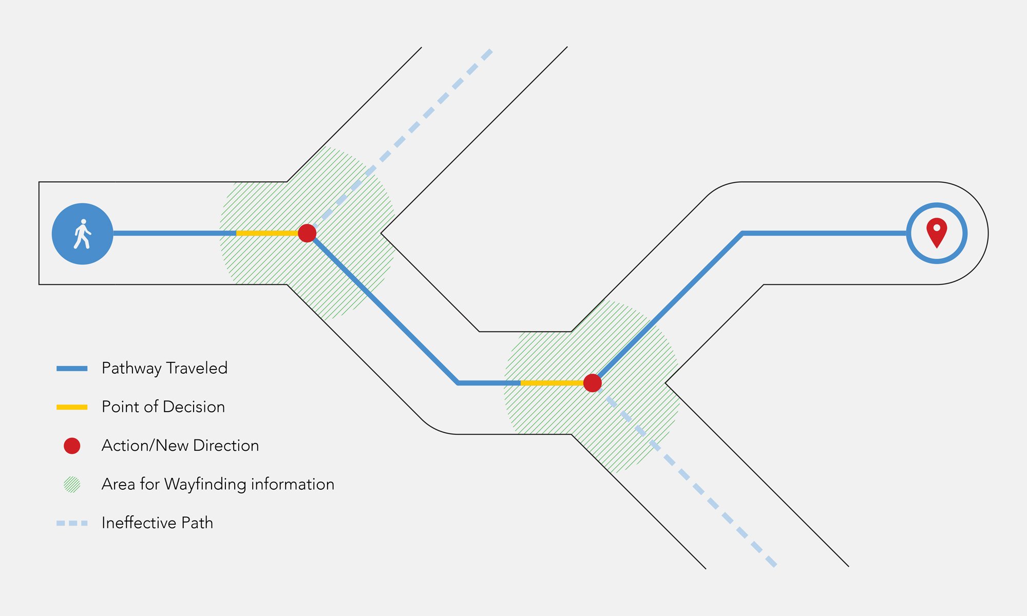
    Wayfinding Decision Infographic showing that wayfinding information is required at all points of decision.
    Wayfinding information is required at all points of decision.

    Wayfinding problems are the sum accumulation of several small problems. Each minor difficulty in orientation leaves a gap in the pedestrian’s spatial awareness. Enough gaps and the end users will be lost. Giving the end user the right information at the right time is how wayfinding overcomes these gaps. This process is often referred to as progressive disclosure — sequencing the disclosure of information based on priorities developed in the previous phase. Progressive disclosure is implemented at critical intersections and major decision points. Providing people with the right information only when they need it cuts down on confusion. Giving major-decision making directions first, like entranceways and parking garages, then more specific destinations/information as you move along a route is considered best practice.

    The way in which the information is implemented relies heavily on the architecture and division of space. People rely on architecture first when looking for navigational clues — only turning to wayfinding when the architecture fails them. This is also true for urban spaces and parks. Rooted in our biological prowess of navigation, people use form, layout, and size as their primary clue givers — all of which are the tools of architecture. Visual landmarks and architectural means such as color, light exposure, and interior decoration are more indicative to navigational aids like passageways, turning points, entrances and egress, and critical decision points.

    These areas of design should be left to the architects and the wayfinding system should play a supportive and harmonious role. The sooner the wayfinding system can be addressed during the process, the easier the integration will be. As a wayfinding planner, using the architecture and people’s natural habits to your advantage will only benefit the overall system. If you do, pedestrians will be more likely to use your directions and have a higher rate of success.

    Information Is Key

    Wafinding Sign System Example showing general construction and design elements.
    Sign system showing general construction and design elements.

    After collecting all the data, cataloging all the locations, and determining the appropriate message for each location and decision point — the next step is to develop the graphic elements and industrial products that will make up the physical components of the wayfinding system. These components can be physically or digitally integrated into the space and will be the “user interface” for your system. Common components are identification and directional signs, maps, physical markers, graphic representations, and precisely generated nomenclature. Developing these components should only be considered after, or near the end, of the information stage. And for good reason. The information collected will dictate graphical elements, like the size needed to display readable copy at the viewing distance, which will in turn affect industrial elements like the build and materials.

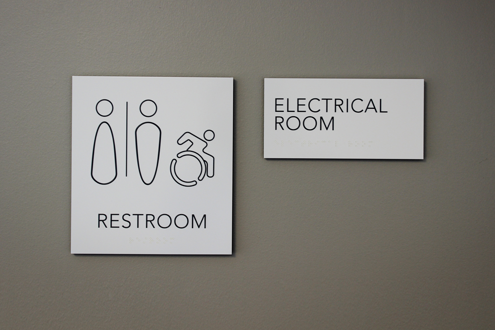
    Restroom and room identification signs with raised copy and clear braille for the visually impaired.

    It all begins and ends with the information. A successful wayfinding system is only possible with successful information design and the final product is only as good as the data you capture. And since wayfinding projects may take months or even years to complete, you don’t want to waste all that time on something that isn’t working. If you have incomplete or inaccurate data, the project will just spin its wheels and whatever solution you develop will be less than satisfactory. With good data, the whole process is a rewarding experience — for the designer(s), client, stakeholders, and end users. Every day, I see first-hand how wayfinding systems can improve people’s experiences and help them find their way. Similar to the bush in front of Ancient Roman taverns, without data and information design, signs would only be pictures on a wall.

    Thanks to my editor—Isaac Levy-Rubinett

    Read the original article on Medium.