Teaching Philosophy
Student Work Examples
Map Design
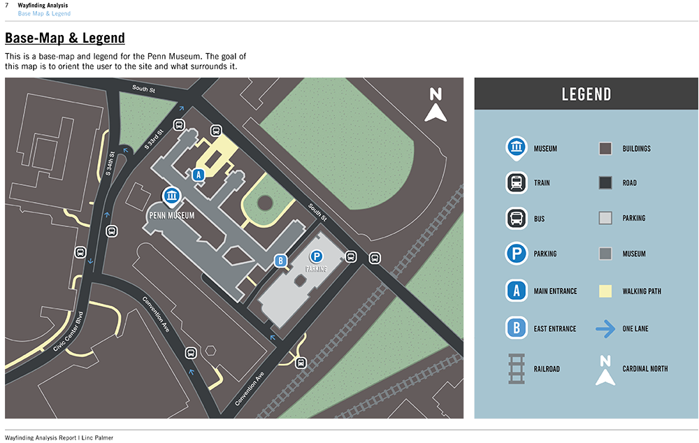
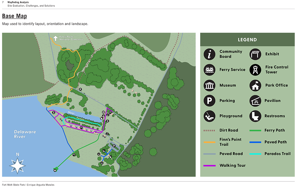
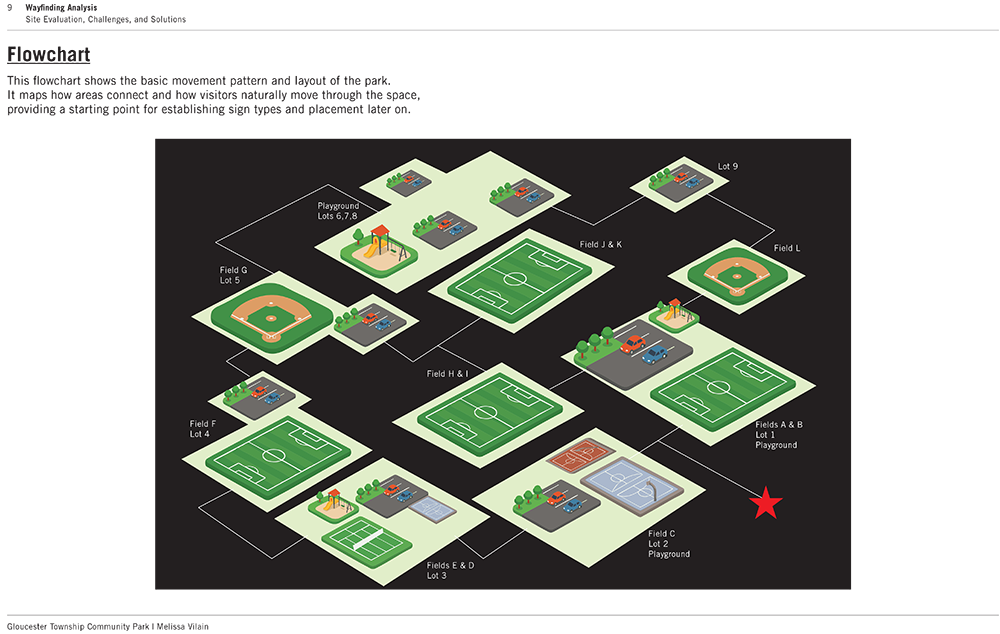
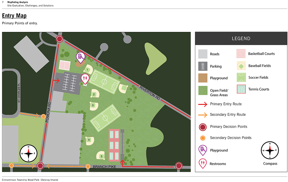
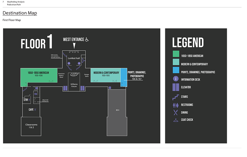
In this project, students transform their field observations into a functional wayfinding map. Working from aerial imagery, existing plans, or their own site documentation, they reconstruct a real environment in Adobe Illustrator, simplifying its complexity into a clear and legible navigational graphic. The emphasis is not on creating an exact geographic representation, but on making thoughtful decisions about what information to include, omit, and emphasize in order to support orientation and movement.
Through the process, students develop an understanding of visual hierarchy, abstraction, symbol design, typography, color, and spatial organization. They learn that effective wayfinding maps communicate relationships rather than raw detail, requiring careful consideration of landmarks, routes, destinations, and user needs. The assignment serves as an introduction to the principles of information design that underpin successful environmental graphics and navigation systems.
Assignment Criteria 100 pts:
- Map Illustration = 40 pts. Clearly communicates routes and spatial relationships with exceptional clarity.
- Information Hierarchy = 40 pts. Demonstrates a strong hierarchy; key information is easily identifiable.
- Graphic Elements = 20 pts. Includes all necessary icons, symbols, and labels with exceptional detail.
Design Development: Creating a Sign System
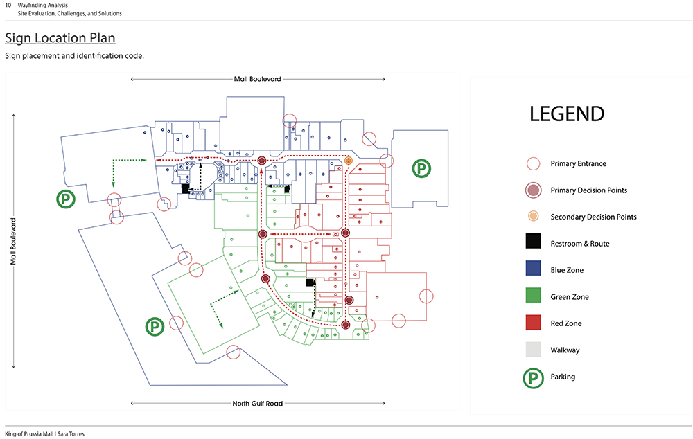
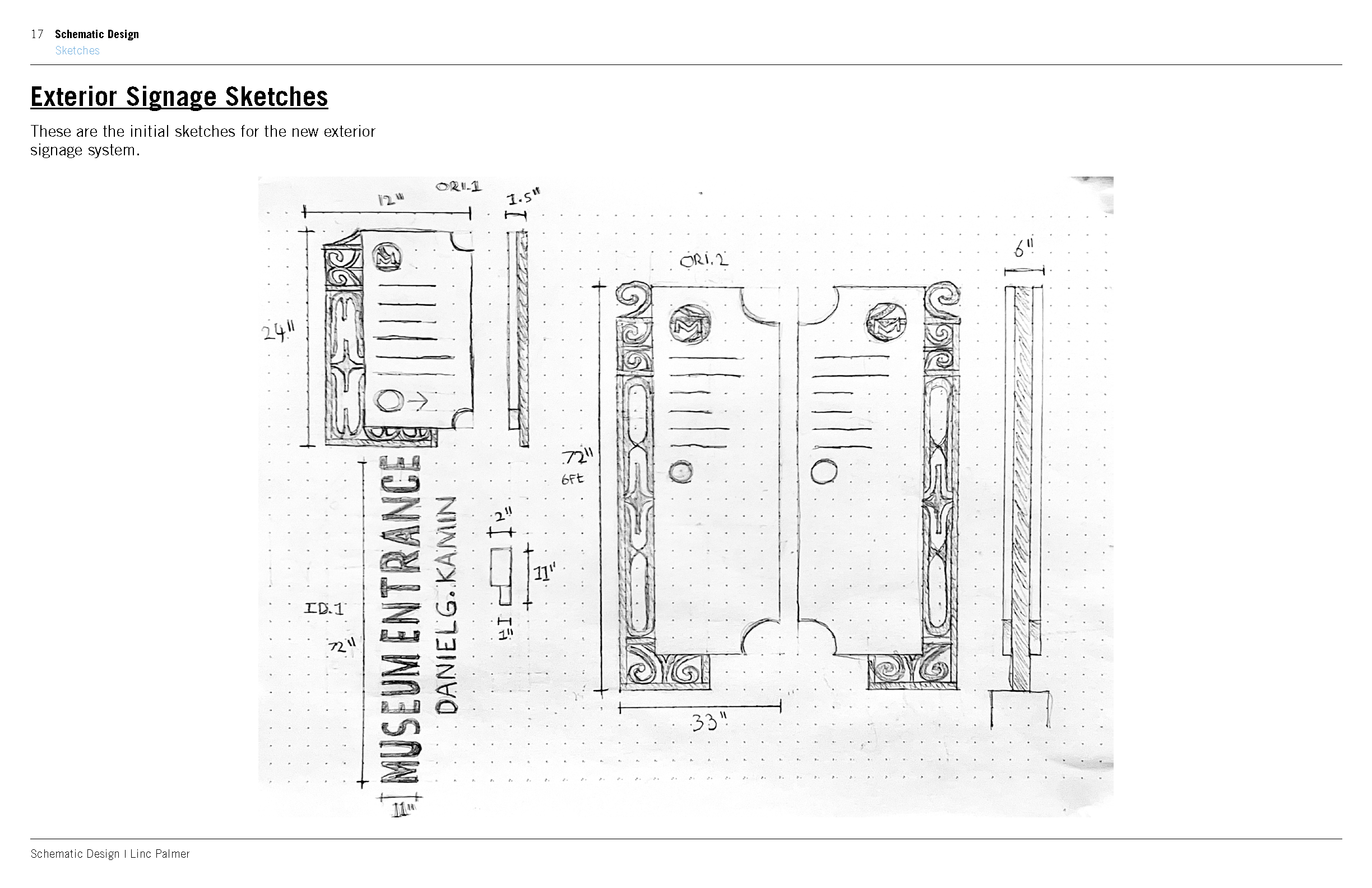
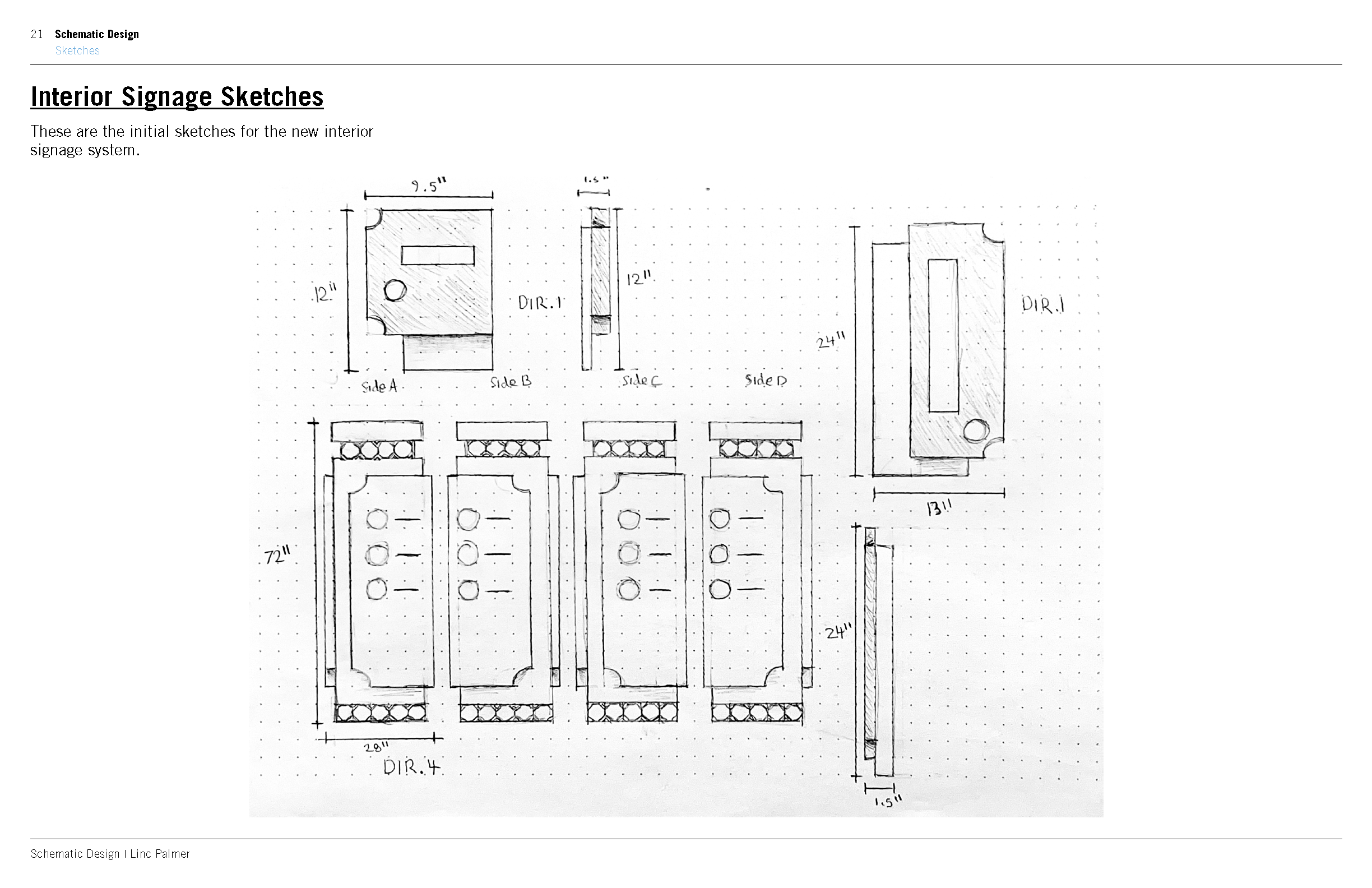
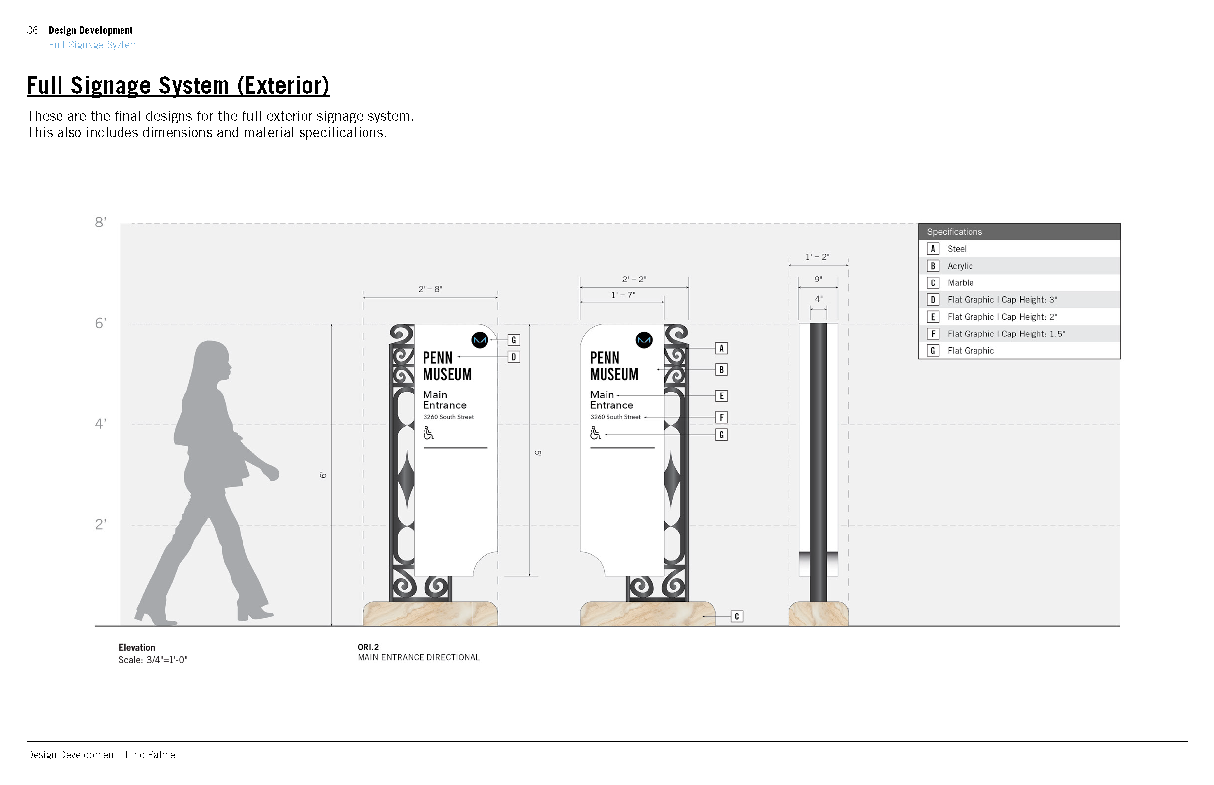
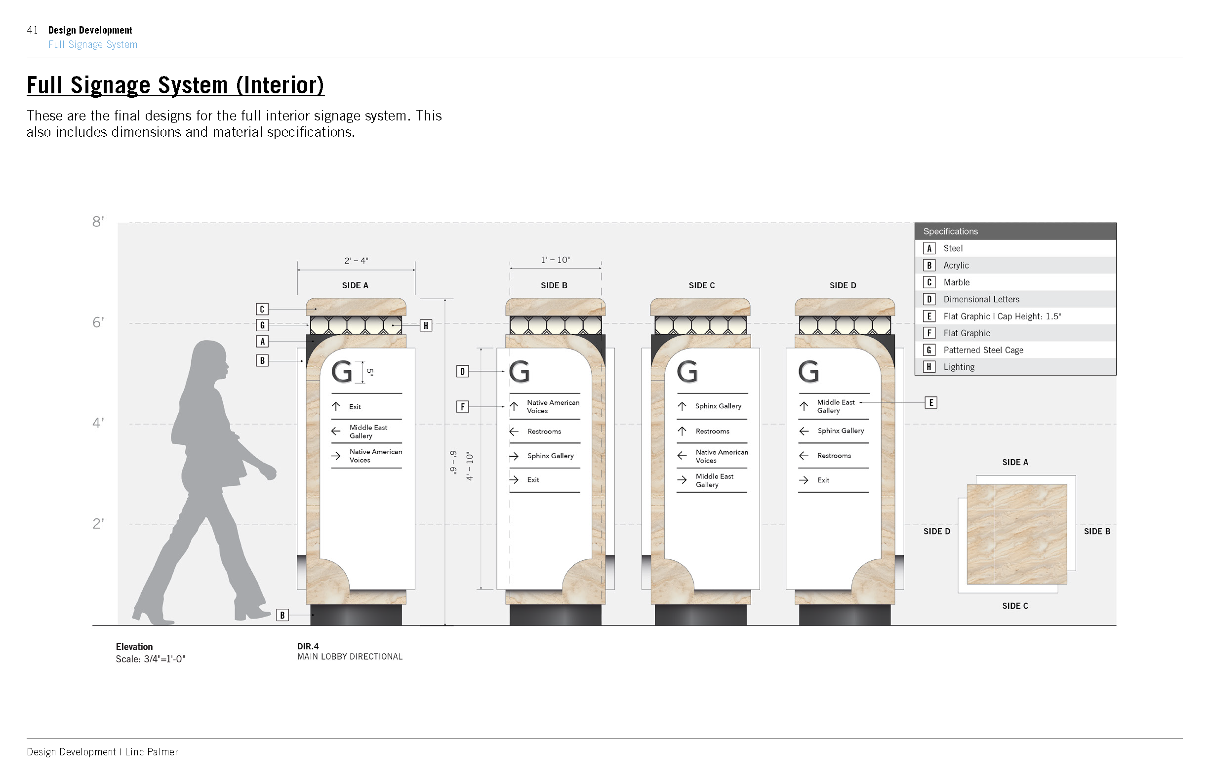
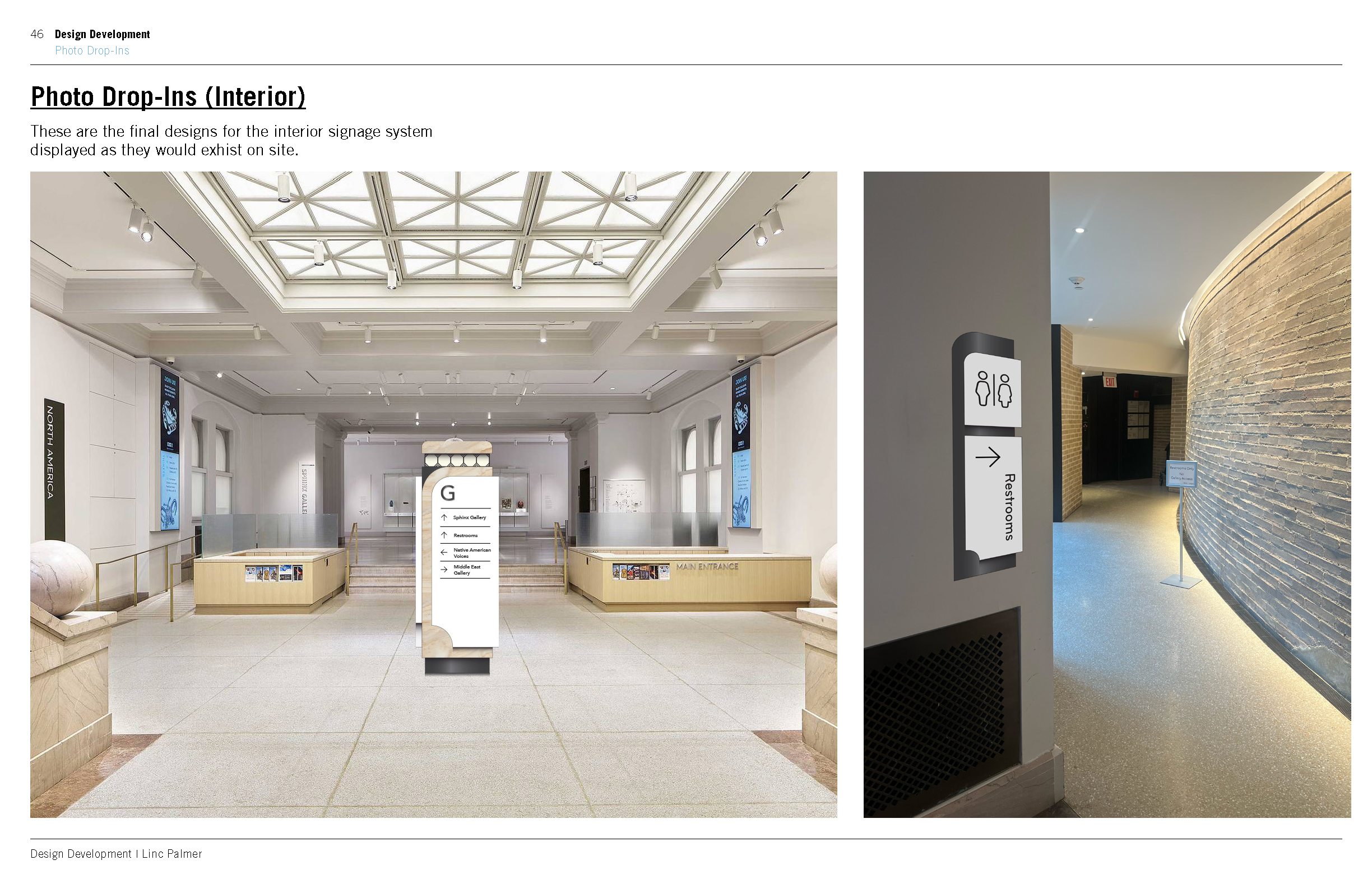
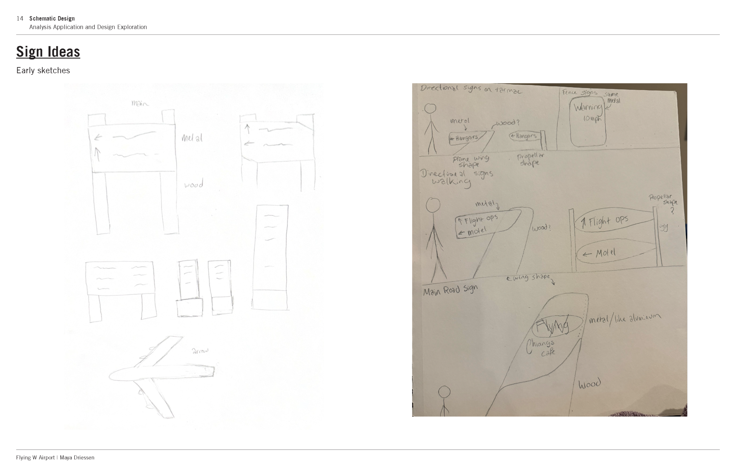
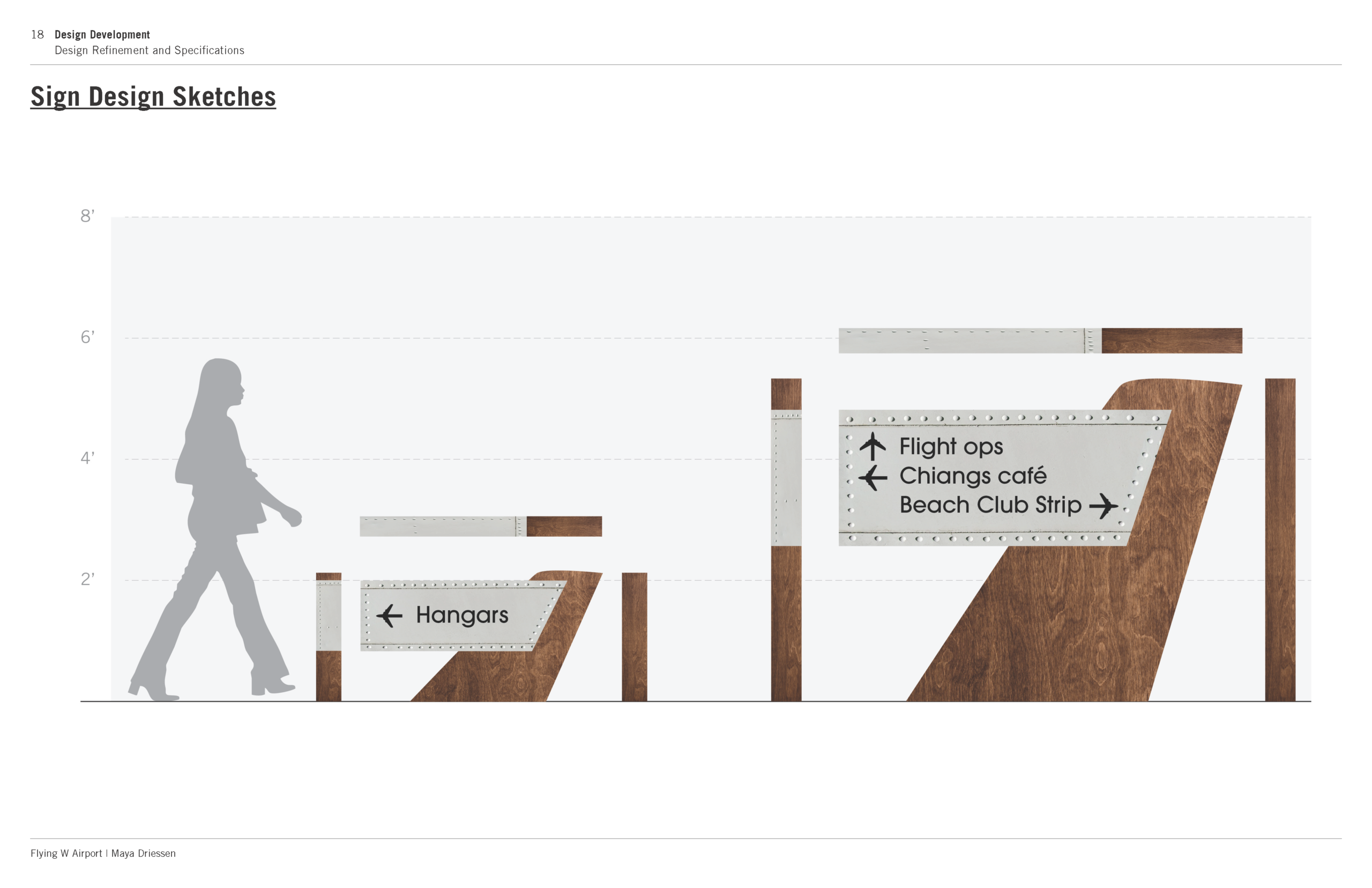
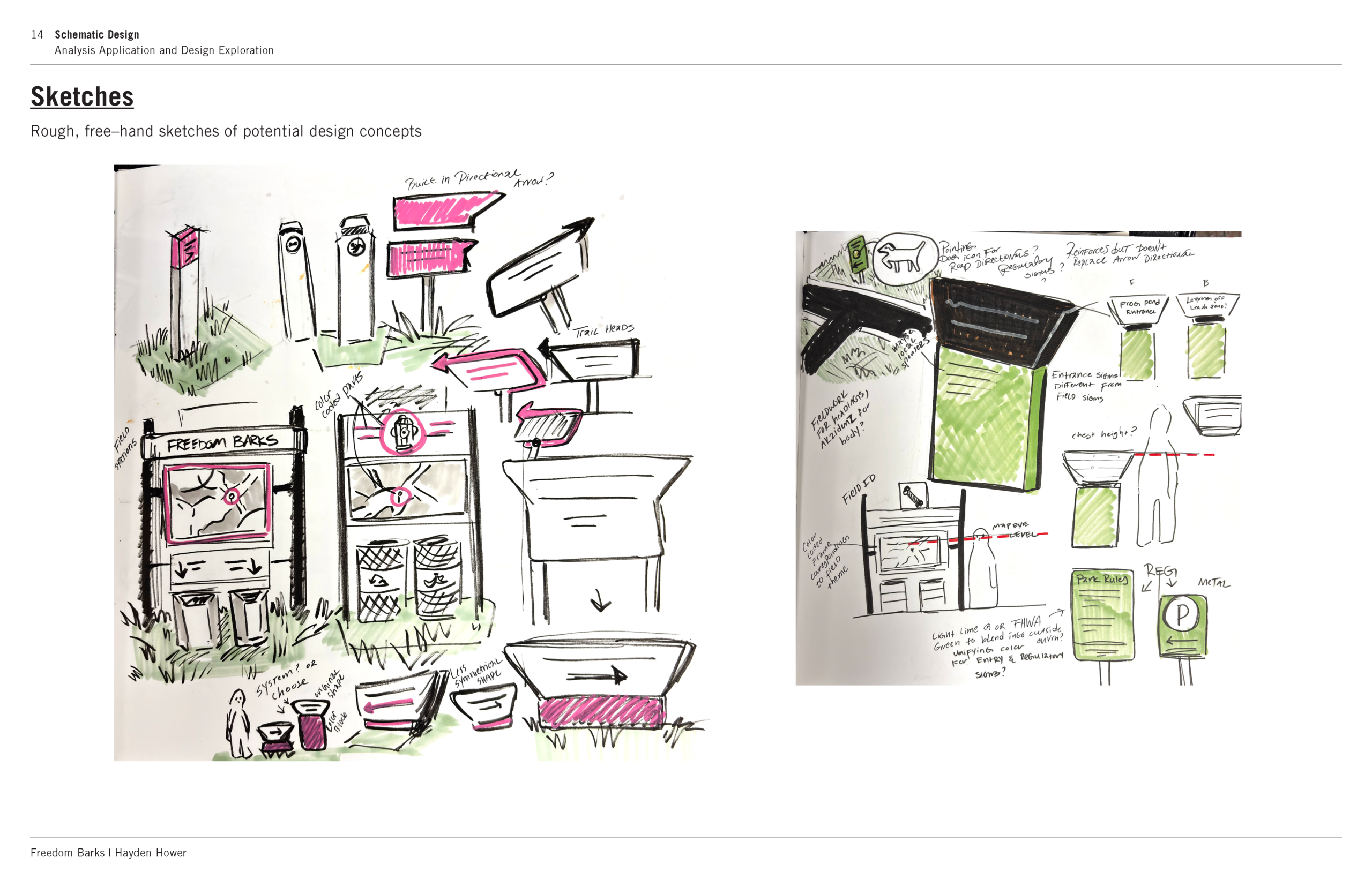
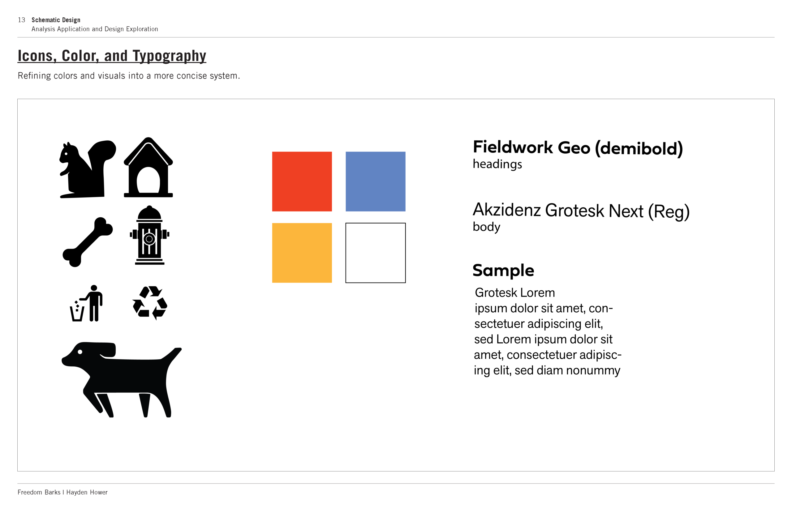
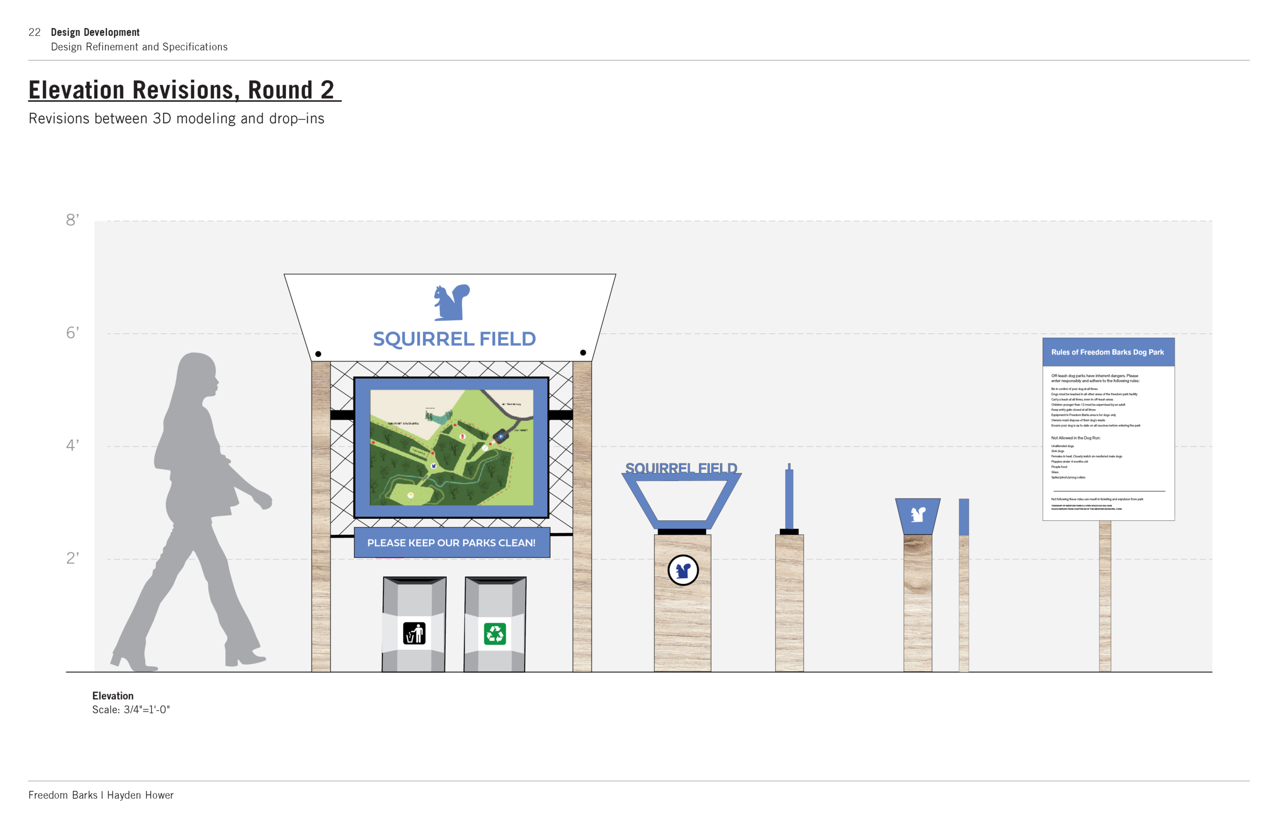
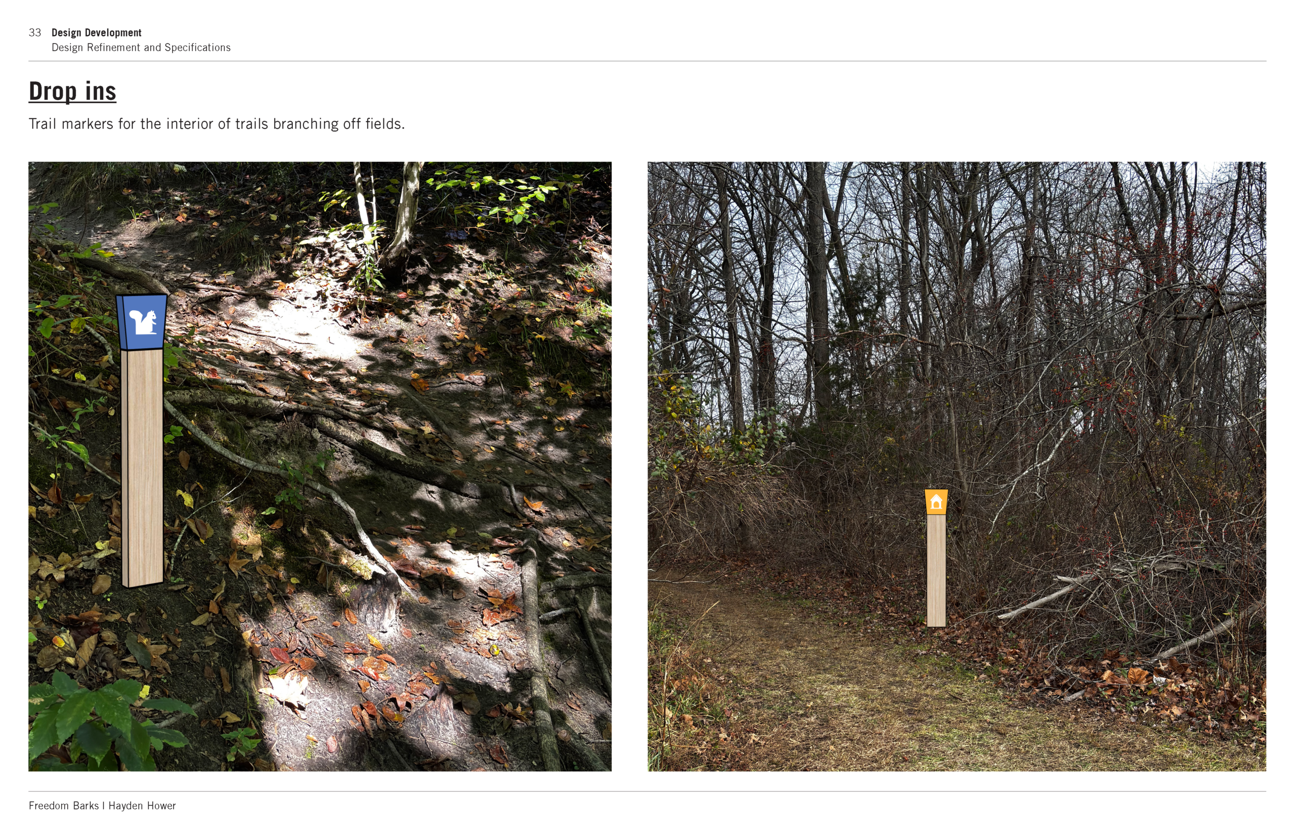
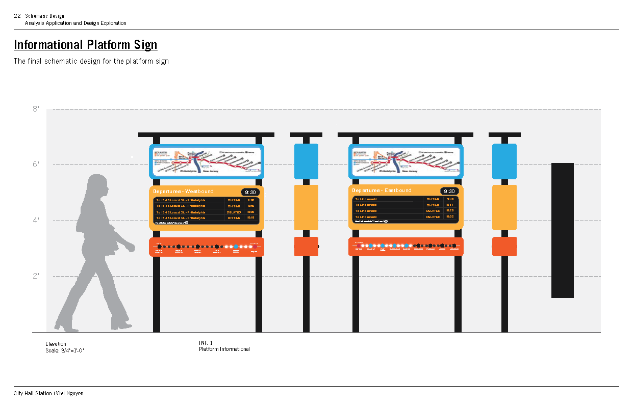
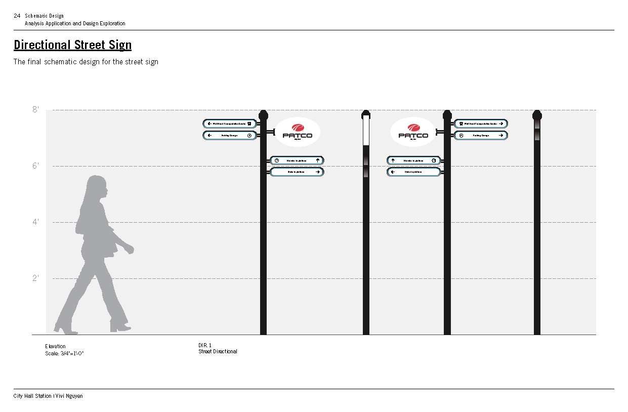
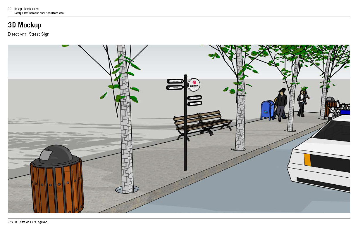
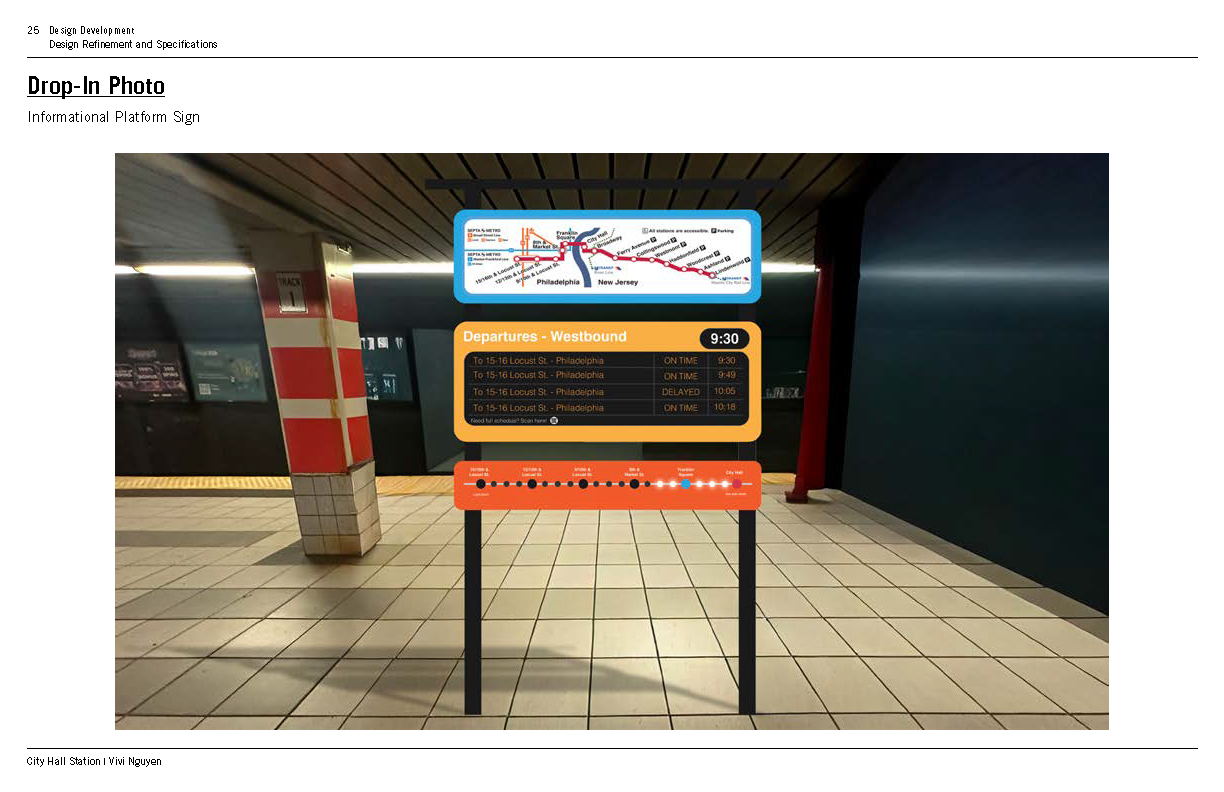
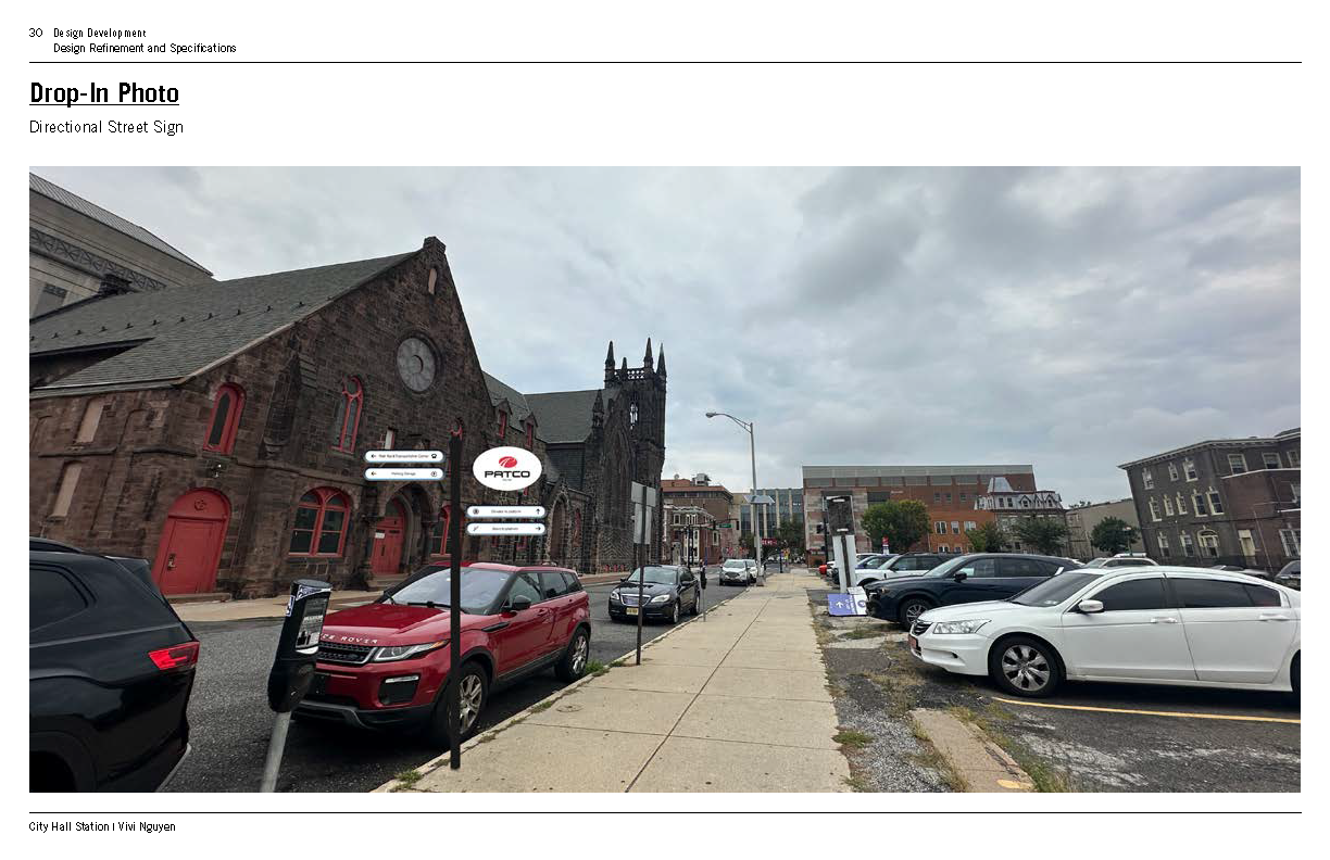
As the capstone project for the course, students develop a comprehensive signage system by refining an earlier schematic concept into a cohesive design solution. Building on feedback from previous critiques, they expand their visual language to encompass the full range of sign types required for their selected site, including identification, directional, and informational signage. The project also introduces students to material exploration, environmental visualization, and presentation techniques used throughout professional design practice.
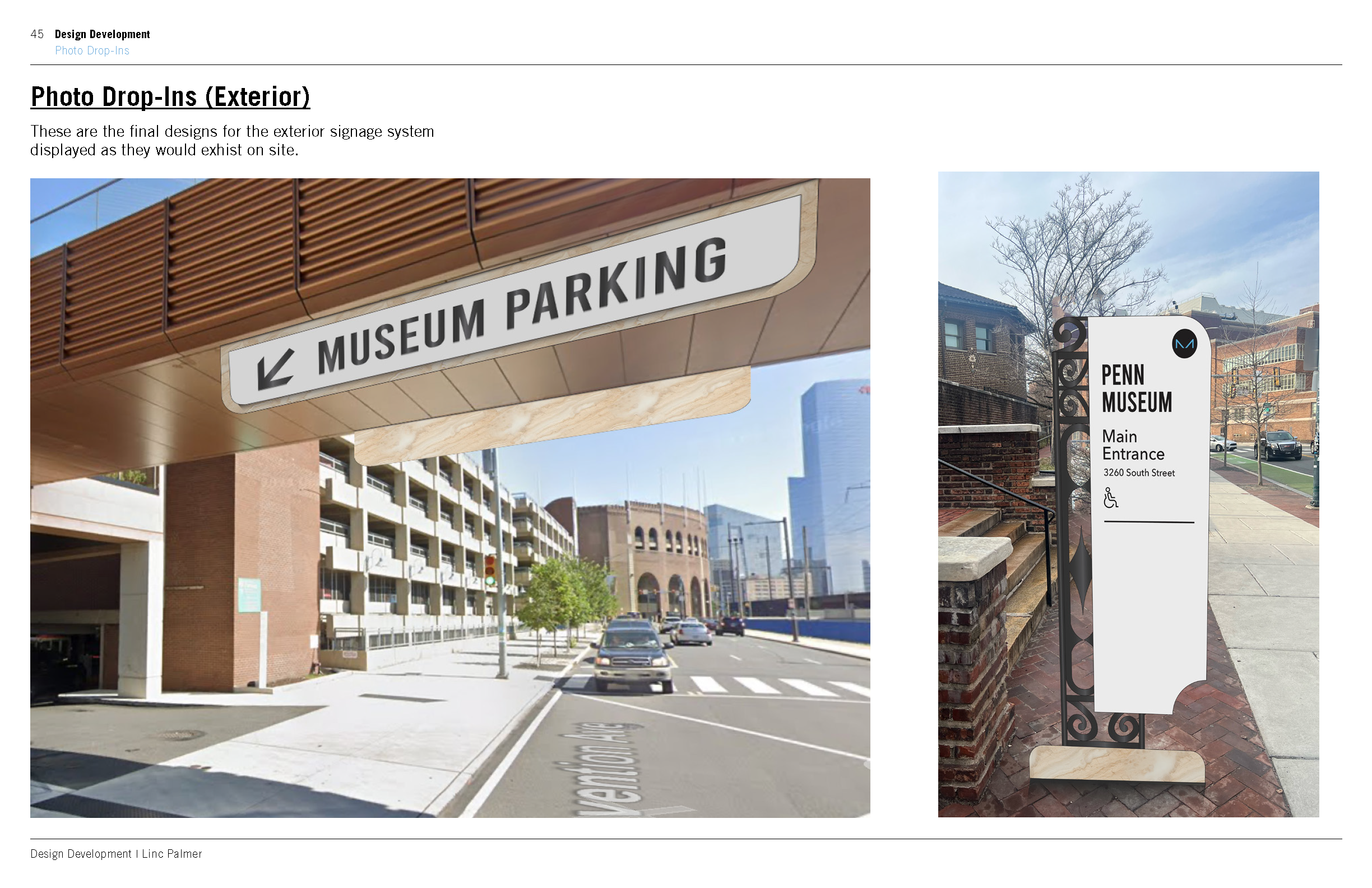
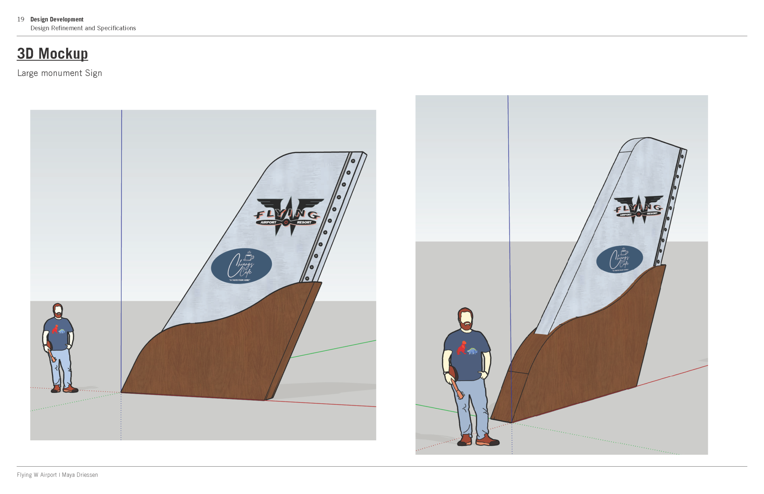
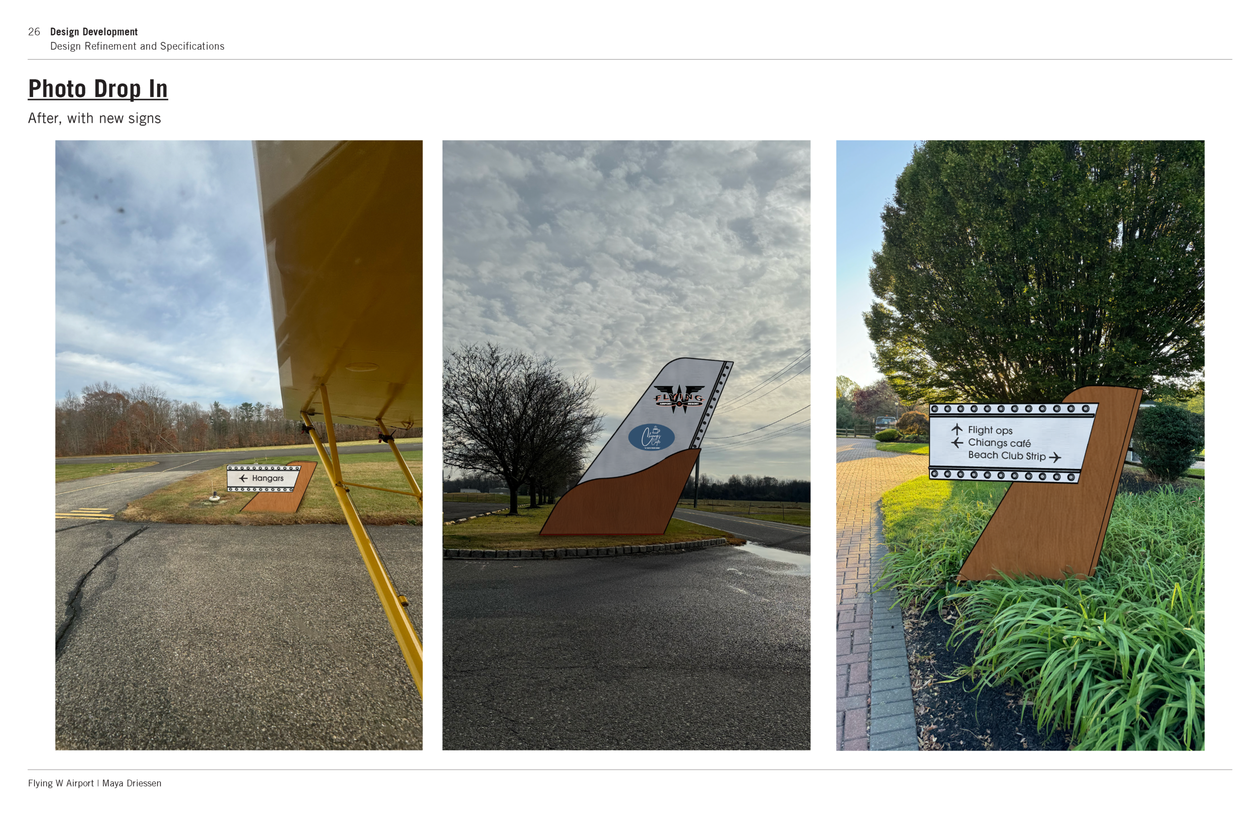
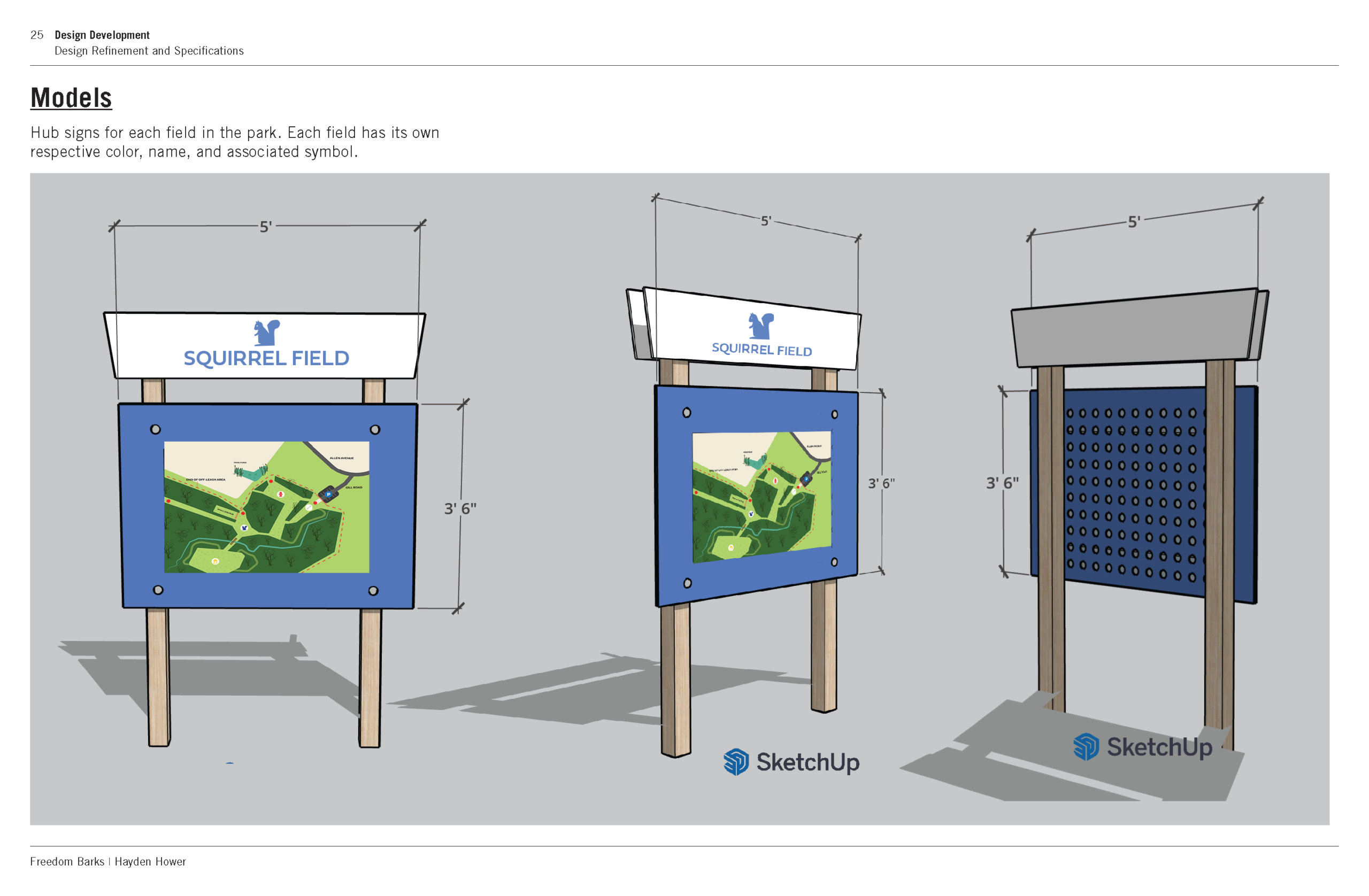
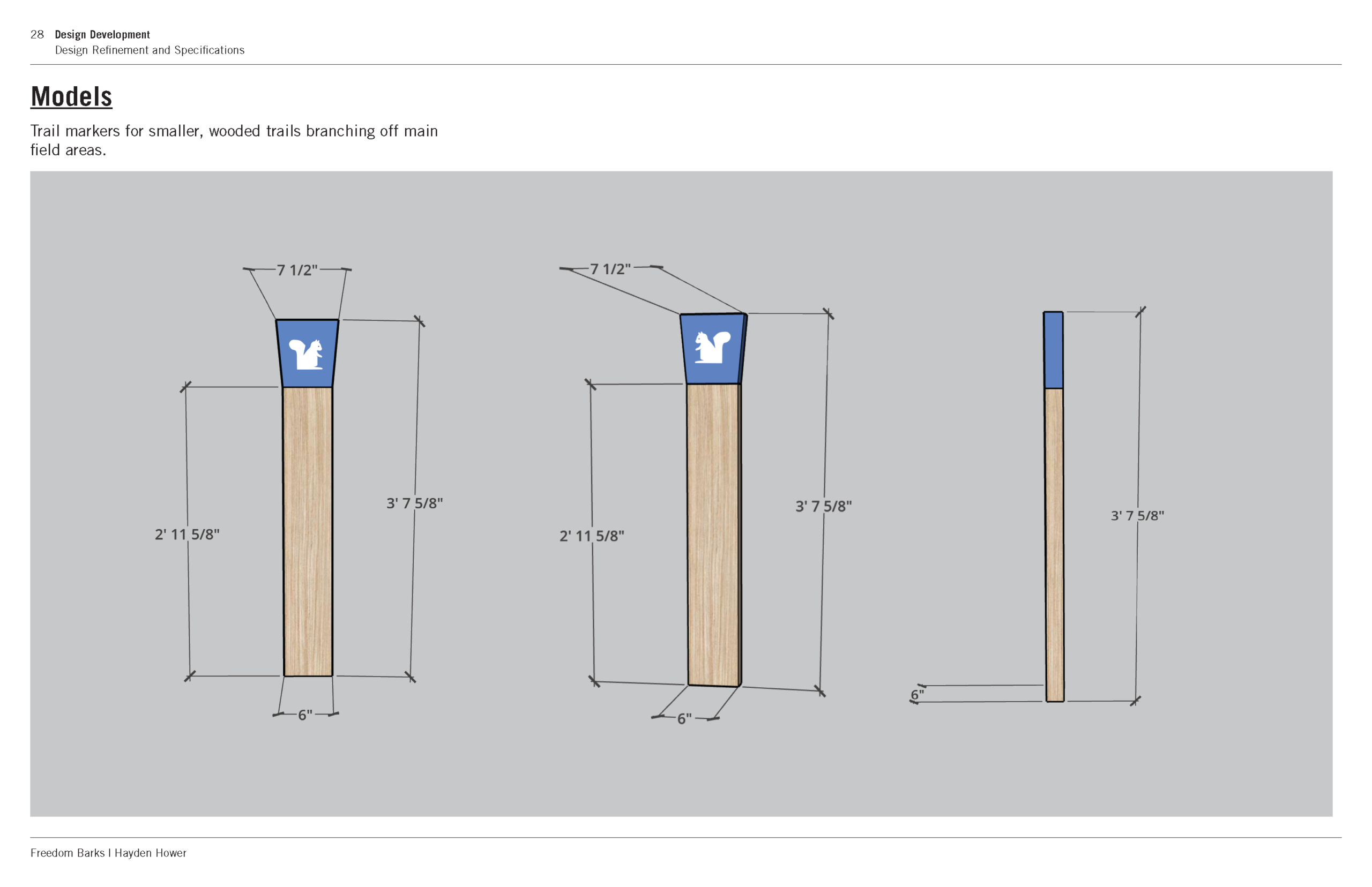
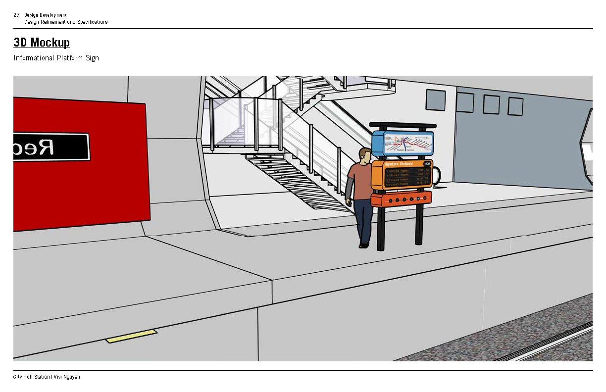
The assignment emphasizes systems thinking, requiring students to maintain consistency across multiple sign types while balancing legibility, accessibility, constructability, and aesthetic expression. Through detailed design elevations, three-dimensional models, and contextual visualizations, students learn how individual signs become part of an integrated wayfinding program. The project reinforces the iterative nature of design development and demonstrates how research, strategy, and graphic design converge to create coherent environmental communication systems.
Assignment Criteria 100 pts:
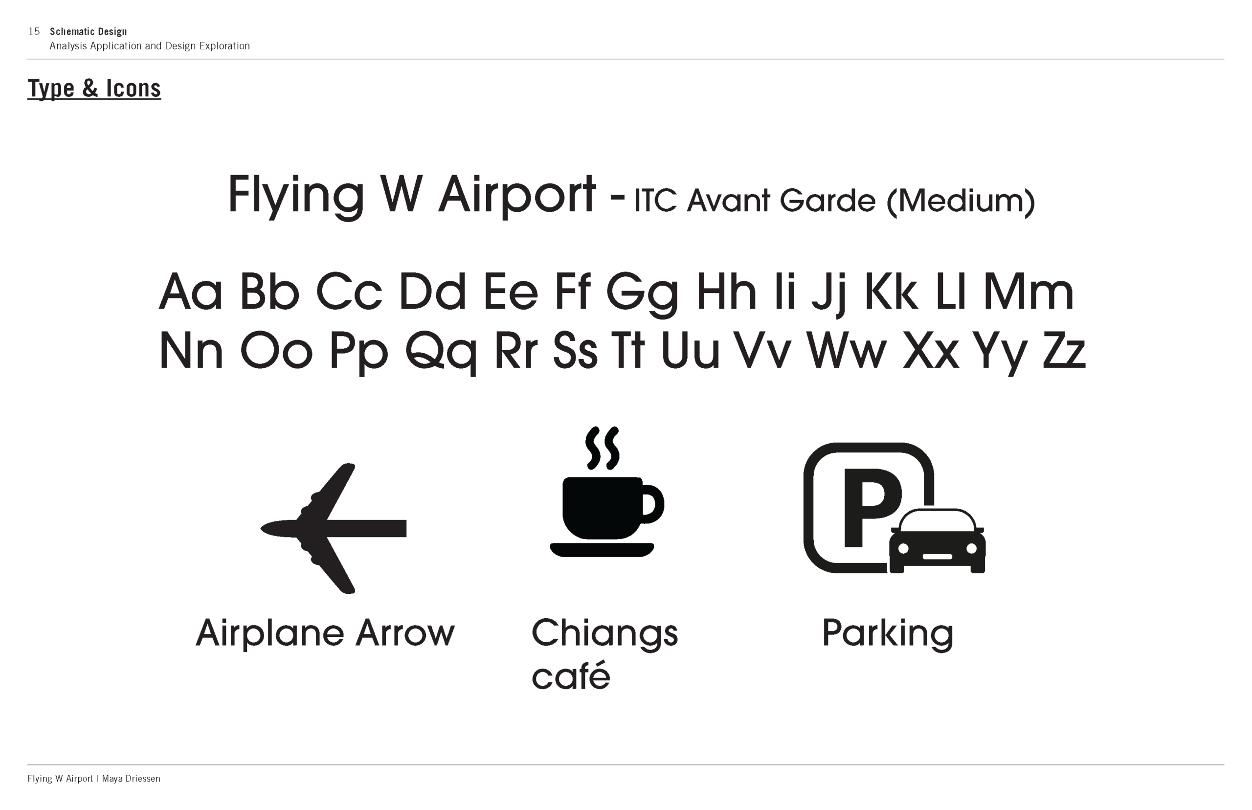
- Refinement = 40 pts. Refined designs demonstrate exceptional clarity, cohesion, and alignment with feedback; typography, color, and iconography are highly polished and professional.
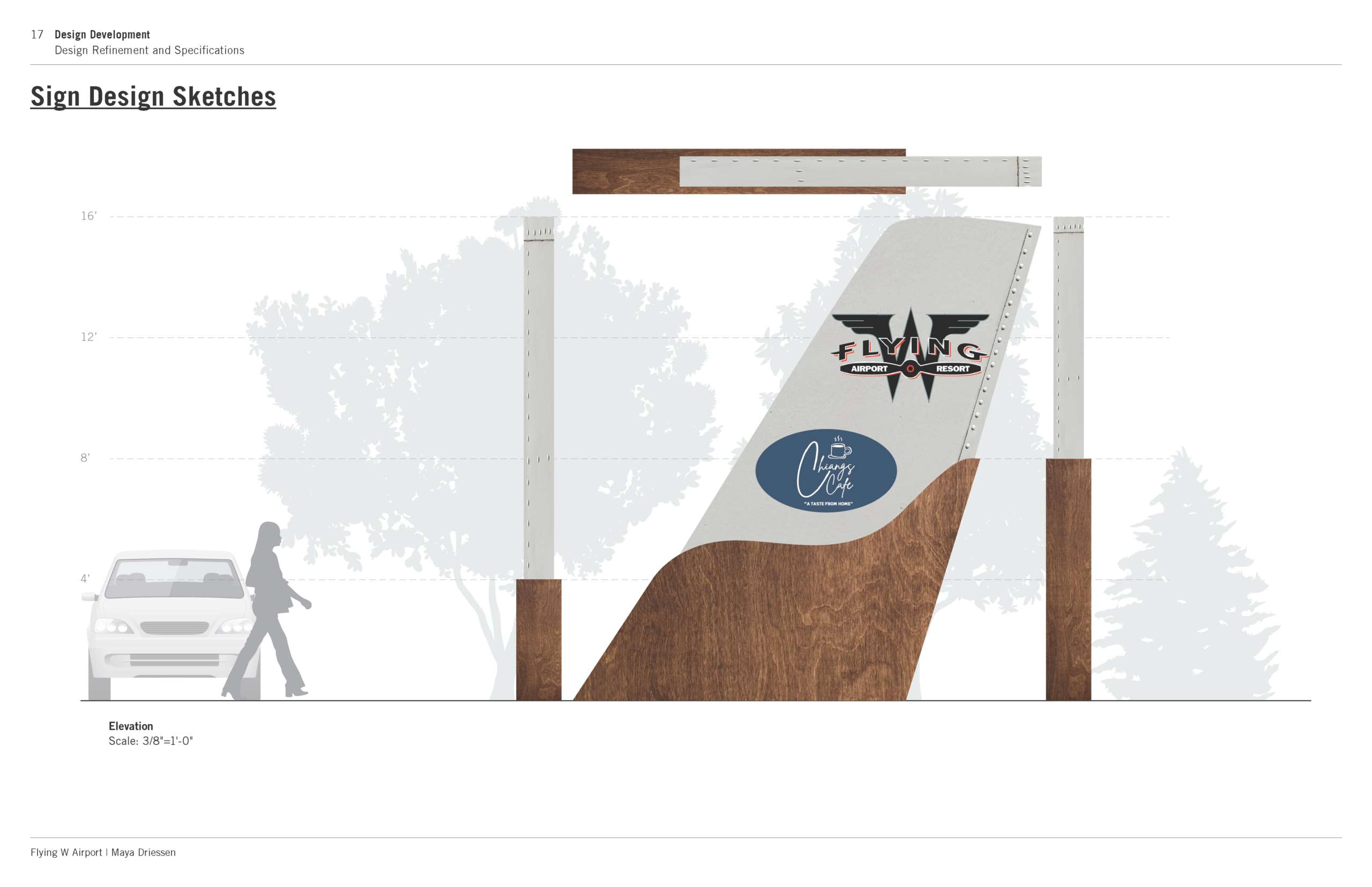
- Expansion = 40 pts. Comprehensive and well-detailed design elevations for all signage types; all signage integrates seamlessly with the refined design direction and is fully functional.
- 3D Models = 20 pts. Using SketchUp, create accurate 3D models that reflect the form, proportions, materials, and colors established in the final signage design.
Lincoln Palmer: Penn Museum
Maya Driessen: Flying W Airport
Hayden Hower: Freedom Barks Dog Park
Vivi Nguyen: PATCO City Hall Station
Designing for a Scaled Environment
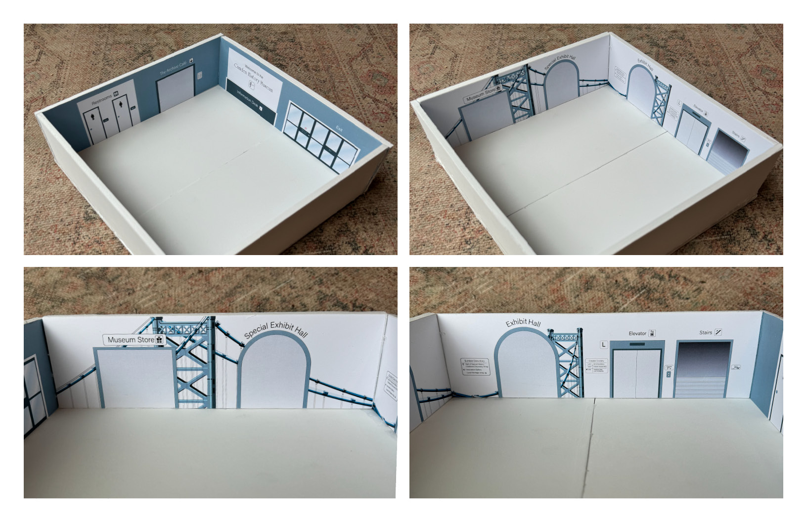
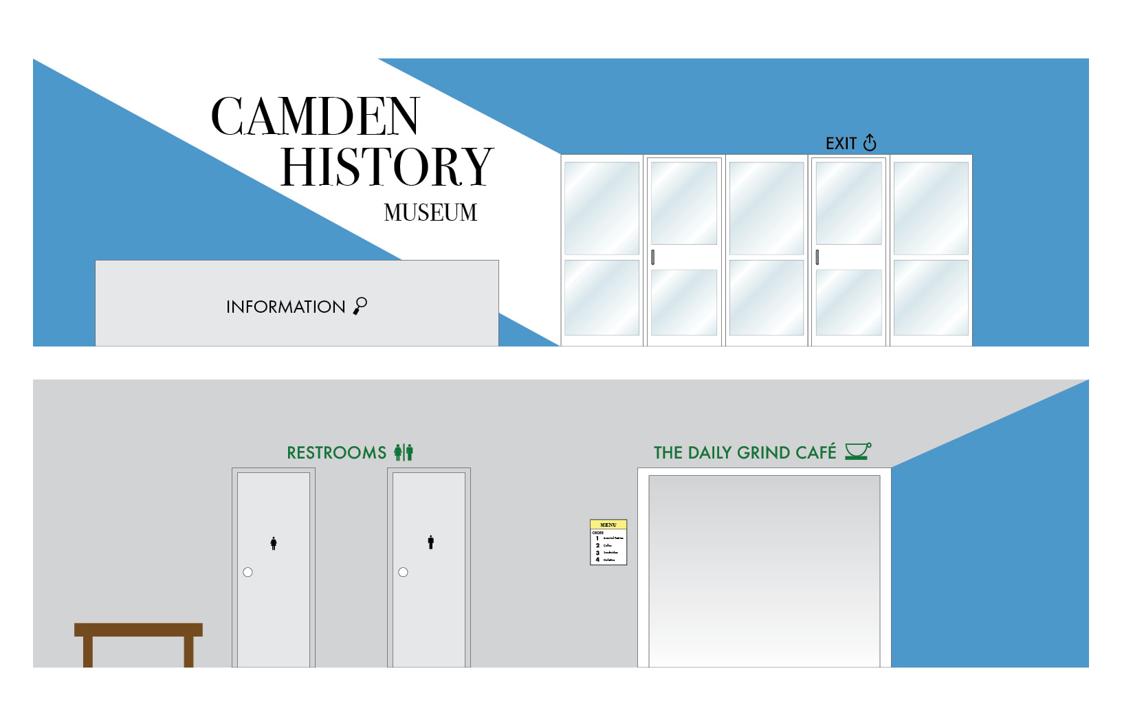
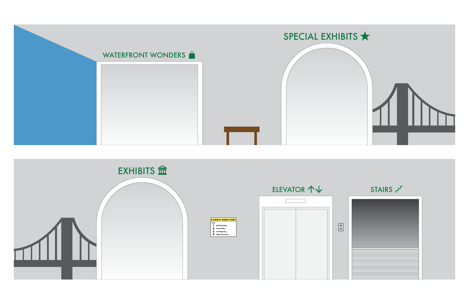
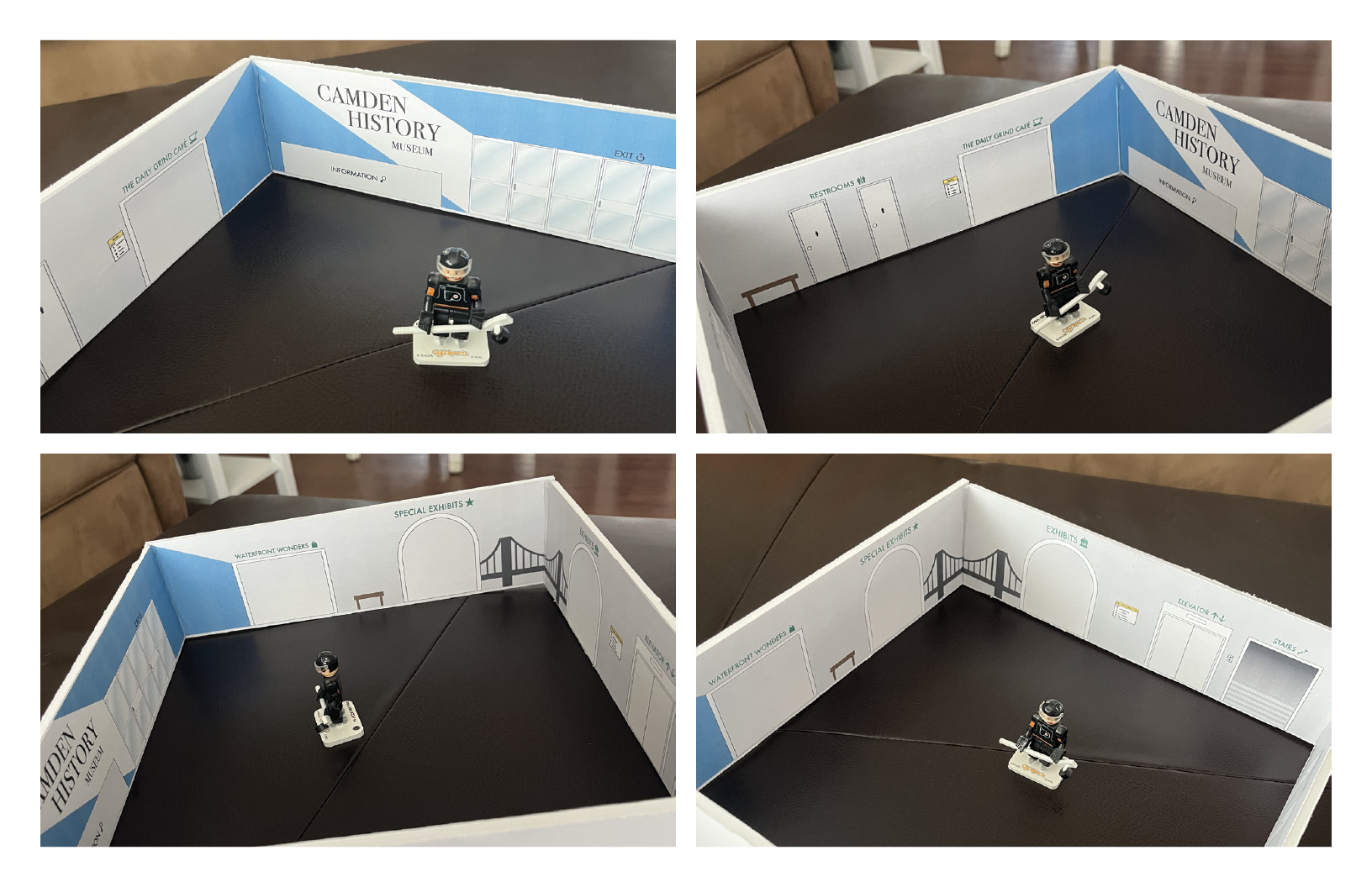
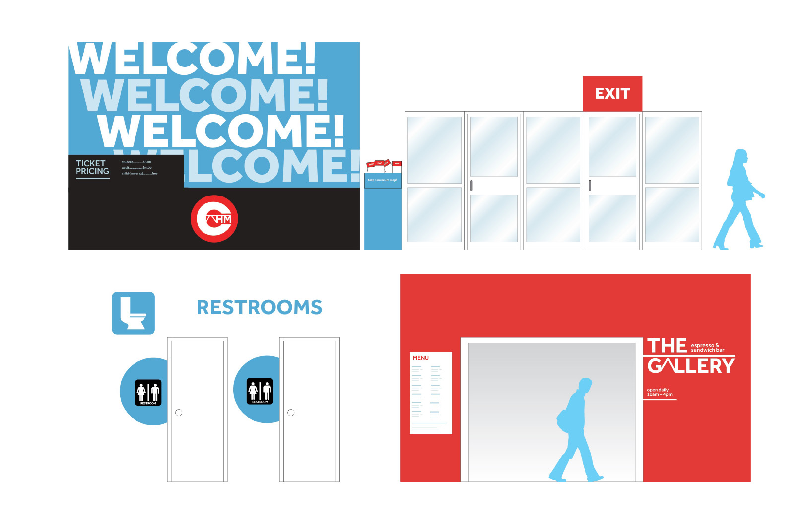
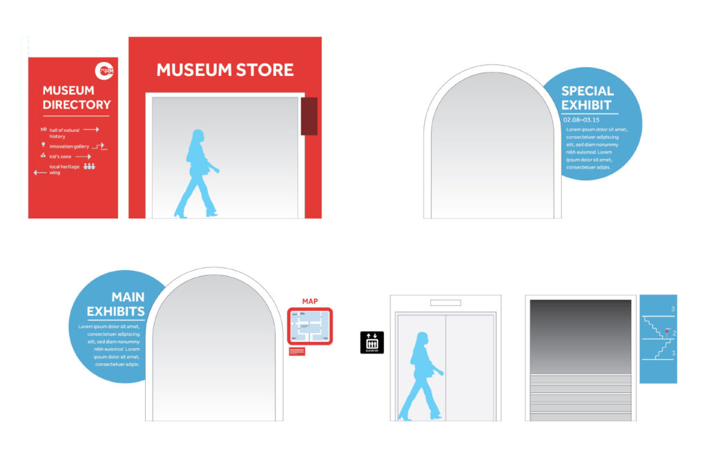
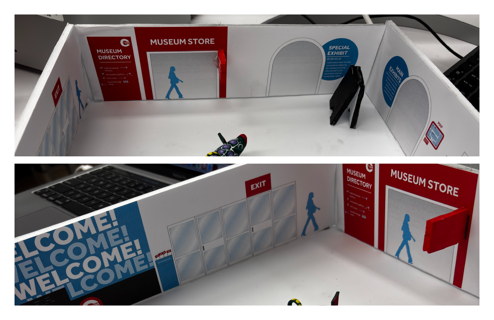
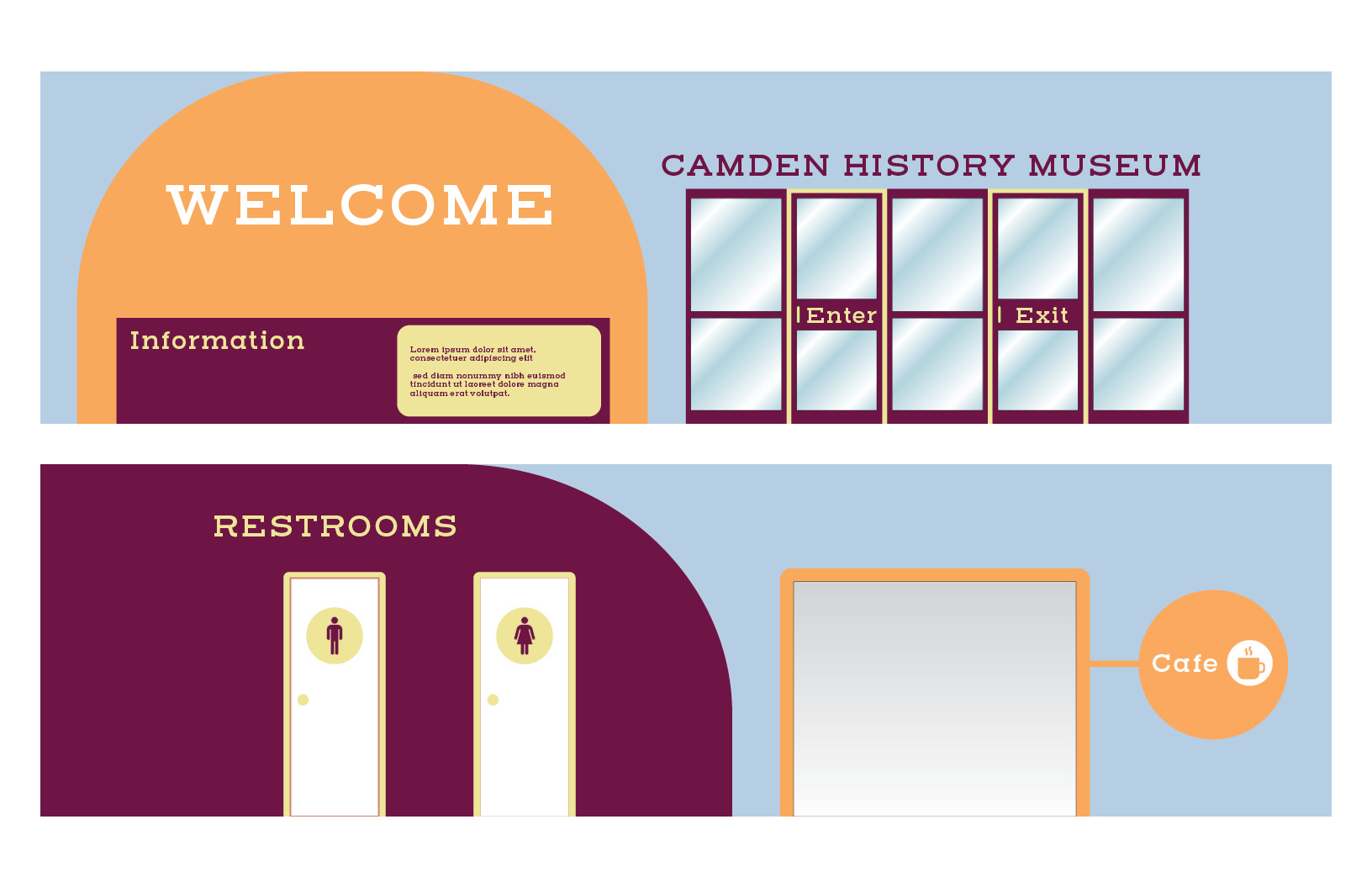
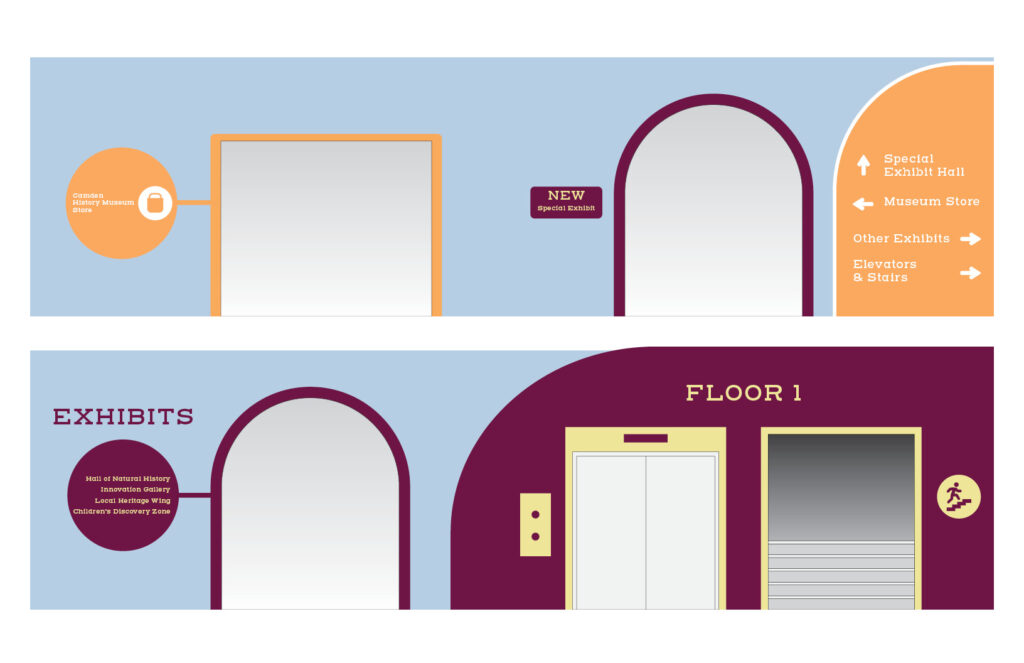
This project introduces students to the relationship between environmental graphics and architectural space. Using a scaled foam-board model of a museum lobby, students develop a coordinated wayfinding system that includes identification, directional, and informational signage integrated directly into the built environment. Rather than designing isolated graphics, students must consider how typography, color, hierarchy, and placement work together to create a cohesive visitor experience.
By designing at scale, students begin to understand how environmental graphics are perceived from different distances, viewing angles, and points of movement. The assignment emphasizes spatial thinking, legibility, and the interaction between graphic communication and architecture. It serves as an introduction to environmental graphic design, encouraging students to see wayfinding not as a collection of signs, but as an integrated system that supports orientation and navigation within physical space.
Assignment Criteria 100 pts:
- Typography = 25 pts. Clear, creative, and well-organized; excellent hierarchy and readability.
- Integration with Diorama = 25 pts. Typography, color, and graphic elements fit seamlessly with the scaled environment; enhances the space and guides viewers effectively.
- Craftsmanship = 25 pts. Exceptionally well-constructed diorama with clean cuts, precise assembly, and high attention to detail.
- Presentation = 25 pts. Sketchbook, digital files, and photos are thorough, polished, and complete; demonstrates excellent effort and organization.
Delaney Imondi:
Hayden Hower:
Isabella Santi:
Maya Driessen: